Hainan Tibetan Autonomous Prefecture
Autonomous prefecture in Qinghai, People's Republic of China
Hainan Prefecture 海南州 · 海南藏族自治州 · མཚོ་ལྷོ་བོད་རིགས་རང་སྐྱོང་ཁུལ | |
|---|---|
 Qinghai Lake | |
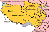
 Location of Hainan Prefecture in Qinghai | |
| Country | People's Republic of China |
| Province | Qinghai |
| Named for | South of Qinghai Lake |
| Prefecture seat | Gonghe County (Qabqa) |
| Area | |
| • Autonomous prefecture | 44,546.21 km2 (17,199.39 sq mi) |
| • Water | 2,981.55 km2 (1,151.18 sq mi) |
| Highest elevation | 5,305 m (17,405 ft) |
| Lowest elevation | 2,168 m (7,113 ft) |
| Population (2020) | |
| • Autonomous prefecture | 446,996 |
| • Density | 10/km2 (26/sq mi) |
| • Rural | 267,100 |
| GDP[1] | |
| • Autonomous prefecture | CN¥ 14.0 billion US$ 2.3 billion |
| • Per capita | CN¥ 30,379 US$ 4,878 |
| Time zone | UTC+8 (China Standard) |
| ISO 3166 code | CN-QH-25 |
| Website | www |
| Hainan Tibetan Autonomous Prefecture | |||||||
|---|---|---|---|---|---|---|---|
| Chinese name | |||||||
| Chinese | 海南藏族自治州 | ||||||
| |||||||
| Tibetan name | |||||||
| Tibetan | མཚོ་ལྷོ་བོད་རིགས་རང་སྐྱོང་ཁུལ | ||||||
| |||||||
Hainan Tibetan Autonomous Prefecture, formerly known as Tsolho Tibetan Autonomous Prefecture[2] (Chinese: 海南藏族自治州; Tibetan: མཚོ་ལྷོ་བོད་རིགས་རང་སྐྱོང་ཁུལ་), is an autonomous prefecture of Northeastern Qinghai Province in Western China. The prefecture has an area of 45,895 square kilometres (17,720 sq mi) and its seat is located in Gonghe County. Its name literally means "south of (Qinghai) Lake."[3]
History
The land of Hainan prefecture was originally inhabited by the Qiang and Rong people. During the Western Han it was incorporated in the Chinese dynasties. In 60 BC, Guide County was established, then called Guan County. It was governed under Jincheng (present day Lanzhou).[3]
Demographics
In 2019, the prefecture had 478,000 inhabitants, with 331,995 belonging to ethnic minorities. The following is a list of ethnic groups in the prefecture, as of 2019.[4]
| Ethnicity | Population | Percentage |
|---|---|---|
| Tibetan | 326,600 | 68.3% |
| Han | 129,000 | 21.5% |
| Hui | 37,100 | 7.8% |
| Tu | 5,700 | 1.2% |
| Mongol | 3,700 | 0.8% |
| Salar | 1,300 | 0.3% |
Administrative divisions
Hainan Prefecture was established in 1953.[5] The prefecture is subdivided into 5 county-level divisions (5 counties):
| Map | ||||||||
|---|---|---|---|---|---|---|---|---|
 Gonghe County Tongde County Guide County Xinghai County Guinan County | ||||||||
| Name | Hanzi | Hanyu Pinyin | Tibetan | Wylie Tibetan Pinyin | Population (2010 Census) | Area (km2) | Density (/km2) | |
| Gonghe County | 共和县 | Gònghé Xiàn | གསེར་ཆེན་རྫོང་ | gser chen rdzong Gêrqên Zong | 122,966 | 16,050 | 7.66 | |
| Tongde County | 同德县 | Tóngdé Xiàn | འབའ་རྫོང་ | 'ba' rdzong Pa Zong | 64,369 | 6,494 | 9.91 | |
| Guide County | 贵德县 | Guìdé Xiàn | ཁྲི་ཀ་རྫོང་ | thri ka rdzong Triga Zong | 101,771 | 3,600 | 28.26 | |
| Xinghai County | 兴海县 | Xīnghǎi Xiàn | བྲག་དཀར་རྫོང་ | brag dkar rdzong Zhag'gar Zong | 76,025 | 13,158 | 5.77 | |
| Guinan County | 贵南县 | Guìnán Xiàn | མང་རྫོང་ | mang rdzong Mang Zong | 76,560 | 6,593 | 11.61 | |
Geography
Hainan is rather mountainous, with the Gonghe basin in the middle of the area. The elevation ranges from 5305 m to 2168 m, averaging 3000 m. The largest lake is Qinghai Lake, and the prefecture is traversed by the Yellow River.
Most of the land, 78.67%, is natural grassland used for grazing. 2.19% is cultivated for agriculture, 4.14% is forest, 6.69% is covered by water and rivers, 0.53% by residential area and industry and the remaining 7.7% consists of barren areas such as glaciers, swamps and desert.[3]
Economy
Hainan's economy is specialized in animal husbandry, hydropower and tourism.[3]
See also
References
- ^ 青海省统计局、国家统计局青海调查总队 (August 2016). 《青海统计年鉴-2016》. 中国统计出版社. ISBN 978-7-5037-7834-6. Archived from the original on 2017-12-28. Retrieved 2017-06-05.
- ^ Committee, Canada Tibet. "Canada Tibet Committee | Library | WTN | Archive | Old". www.tibet.ca. Retrieved 2017-07-14.
- ^ a b c d "青海海南藏族自治州". National Ethnic Affairs Commission.
- ^ "海南州政府网-走进海南". www.hainanzhou.gov.cn. Retrieved 2021-05-09.
- ^ 中国民族经济 (in Chinese). 中国统计出版社. 1993.
Further reading
- A. Gruschke: The Cultural Monuments of Tibet’s Outer Provinces: Amdo - Volume 1. The Qinghai Part of Amdo, White Lotus Press, Bangkok 2001. ISBN 974-480-049-6
- Tsering Shakya: The Dragon in the Land of Snows. A History of Modern Tibet Since 1947, London 1999, ISBN 0-14-019615-3
External links
- Hainan Tibetan Autonomous Prefecture Government Website
- v
- t
- e
cities
| Xining | |
|---|---|
| Haidong |
prefectures
| Haibei | |
|---|---|
| Huangnan | |
| Hainan | |
| Golog | |
| Yushu | |
| Haixi |
|
- 1 These are administrative zones, which are not standard units of local government, though they do function as such.

| |||||||||
|---|---|---|---|---|---|---|---|---|---|
| Regions |
|  | |||||||
| Prefectures and counties |
| ||||||||
| |||||||||
36°17′N 100°37′E / 36.29°N 100.62°E / 36.29; 100.62


