Mount Yakushi
Mountain in the country of Japan


Toyama, Toyama Prefecture,
Japan
Japan
50000:1 槍ヶ岳
Mount Yakushi (薬師岳, Yakushi-dake) is one of the 100 Famous Japanese Mountains,[3] reaching the height of 2,926 m (9,600 ft). It is situated in Japan's Hida Mountains in Toyama Prefecture. It was specified for Chūbu-Sangaku National Park on December 4, 1934.[4]
Outline
There are a lot of mountains with the same name in Japan, but this is the highest peak. It is a mountain of the Faith for a long time as well as Mount Tate and Mount Ontake. Bhaisajyaguru is enshrined in the Shinto shrine on the top of the mountain.
History
- It was the mountain of no admittance for women before the Meiji period.
- 1885 – Benjamin Smith Lyman climbed this mountain and Mount Yari by the purpose of the measurement investigation etc.[5]
- 1904 – Geologist's Naomasa Yamasaki discovered Cirque on the east side of the mountain.[6]
- 1909 – English literature's Jūji Tanabe climbed, and published the book on travel of mountain.[7]
- 1926 – Writer Kyūya Fukada climbed, and published 100 Famous Japanese Mountains in 1964.[8]
- December 4, 1934 – This area was specified to the Chūbu-Sangaku National Park.[4]
- March 29, 1952 – The cirque of Mount Yakushi was specified for the special Natural monument.
- January 15, 1963 – 13 members of Aichi University met an accident in this mountain where a large amount of snows piled, and died.[9]
Cirque on Mount Yakushi

There are 4 large Cirque on the east side of the mountain.
- Northern cirque – It is not plain because it collapsed.
- Kanasaku valley cirque – This was originated by person's name of Kanasaku Miyamoto. It is between Mount kita-Yakushi and Mount Yakushi.
- Central cirque – It is on the southeast side of Mount Yakushi.
- Southern cirque – It is on the southeast of Central cirque.
Mountaineering
Main ascent routes
There are several climbing routes to the top of the mountain.[10][11]
- Entrance Arimine (Oritate) : Oritate – Tarōdaira hut – Yakushi mountain pass – Yakushi plain (Yakushi-daira) – Yakushi mountain cottage – Mount Yakushi. This is the shortest route.
- Hietsu-shin-dō (Hietsu new route) : Hietsu Tunnel – Sennin mountain pass – Kagami pond – Mount Teraji – Kitanomata hut – Tarōdaira hut – Yakushi mountain pass – Yakushi plain – Yakushi mountain cottage – Mount Yakushi. Also there is Kamioka-shin-dō (Kamioka new route) for Mount Teraji.
- From Mount Tate : Murodō – Mount Tate – Ichinokosi mountain cottage – Mount Shishi – Zara mountain pass – Goshikigahara – Mount Ecchuzawa – Sugonokkoshi hut – Hazama Mountain – Mount Kita-Yakushi – Mount Yakushi.
- From Mount Kurobegorō : Mount Kurobegorō – Mount Kitanomata – (Mount Tarō) – Tarōdaira hut – Yakushi mountain pass – Yakushi plain – Yakushi mountain cottage – Mount Yakushi. There are several route for Mount Kurobegorō.
Mountain hut

Thera are several Mountain hut around Mount Yakushi.[11] Yakushi mountain cottage is the nearest hut.
- Sugonokkoshi hut (スゴ乗越小屋, Sugonokkoshi-goya) – in the col between Mount Ecchuzawa and Mount Hazama (with Campsite), 50 person accommodation
- Yakushi mountain cottage (薬師岳山荘, Yakushidake-sansō) – between Mount Yakushi and Yakushi plain, 60 person accommodation
- Yakushizawa hut (薬師沢小屋, Yakushizawa-goya) – between Mount Taro and Kumonotaira, on Kurobe River ashore, 60 person accommodation
- Tarōdaira hut (太郎平小屋, Tarōdaira-goya) – between Yakushi mountain pass and Mount Tarō (with Campsite on Yakushi mountain pass), 150 person accommodation
- Kitanomata hut (北ノ俣避難小屋, Kitanomata-goya) – in the col between Mount Teraji and Mount Kitanomata (Shelter hut), 8 person accommodation
- Kurobegorō hut (黒部五郎小舎, Kurobegorō-goya) – in the col between Mount Kurobegorō and Mount Mitsumatarenge (with Campsite), 60 person accommodation
- Mitsumata mountain cottage (三俣山荘, Mitsumata-sansō) – in the col between Mount Mitsumatagenge and Mount Washiba (with Campsite), 70 person accommodation
Alpine plant
The upper part of this mountain is situated in Tree line region, Siberian Dwarf Pine and Alpine plant grow naturally. There are quite a lot of kinds of alpine plant in the surrounding, and it is selected to "the 100 famous Japanese mountains of flower" by Sumie Tanaka.[12]
- around Yakushi plain : Phyllodoce aleutica, Nephrophyllidium, Gentiana thunbergii var. minor, Anemone narcissiflora, Trollius japonicus, Siberian Dwarf Pine etc.
- around Yakushi mountain pass : Paris japonica, Maianthemum dilatatum, Caltha palustris etc.
- around Tarōdaira hut : Veratrum stamineum, Geum pentapetalum, Geranium yesoemse var. nipponicum, Lysichiton camtschatcense, Ranunculus acris, Pedicularis chamissonis var. japonica, Eriophorum vaginatum etc.
| Anemone narcissiflora | Caltha palustris | Paris japonica | Ranunculus acris | Siberian Dwarf Pine |
|---|---|---|---|---|
 |  |  |  |  |
Geography
Nearby mountains
| Image | Mountain | Elevation | Distance from the Top | Note |
|---|---|---|---|---|
 | Mt. Tate 立山 | 3,015 m (9,892 ft) | 13.7 km (8.5 mi) | 100 Famous Japanese Mountains |
 | Mt. Ecchuzawa 越中沢岳 | 2,591.42 m (8,502 ft) | 6.2 km (3.9 mi) | |
 | Mt. Akaushi 赤牛岳 | 2,864.23 m (9,397 ft) | 5.3 km (3.3 mi) | 200 Famous Japanese Mountains |
 | Mt. Yakushi 薬師岳 | 2,926.01 m (9,600 ft) | 0 km (0.0 mi) | 100 Famous Japanese Mountains |
 | Mt. Kitanamata 北ノ俣岳 | 2,662 m (8,734 ft) | 6.0 km (3.7 mi) | |
 | Mt. Suishō 水晶岳 | 2,986 m (9,797 ft) | 7.0 km (4.3 mi) | another name is Mount Kuro 100 Famous Japanese Mountains |
 | Mt. Kurobegorō 黒部五郎岳 | 2,839.58 m (9,316 ft) | 8.5 km (5.3 mi) | 100 Famous Japanese Mountains |
Rivers
The mountain is the source of the following rivers, each of which flows to the Sea of Japan.[11]
- tributary of the Jōganji River
- tributaries of the Kurobe River
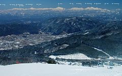
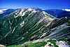
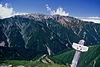
Scenery of Mount Yakushi
| from Mt. Kotanomata | from Mt. Mitsumatarenge | from Mt. Suishō | from Mt. Akazawa |
|---|---|---|---|
 |  |  |  |
References
- ^ "Information inspection service of the Triangulation station" (in Japanese). Geospatial Information Authority of Japan,(高山-槍ヶ岳-薬師岳). Archived from the original on June 9, 2009. Retrieved January 24, 2011.
- ^ a b "Map inspection service" (in Japanese). Geospatial Information Authority of Japan,(高山-槍ヶ岳-三俣蓮華岳). Retrieved January 24, 2011.
- ^ 100 Famous Japanese Mountains (in Japanese). The Asahi Shimbun Company. 1982. pp. 192–195. ISBN 4-02-260871-4.
{{cite book}}:|work=ignored (help) - ^ a b "Chūbu-Sangaku National Park". Ministry of the Environment. Archived from the original on February 27, 2012. Retrieved January 24, 2011.
- ^ Magazine of museum about Northern Japanese Alps (climbing mountain and Folkloristics) (in Japanese). Shinanoji, ASIN B000J9DVK8. 1972.
{{cite book}}:|work=ignored (help) - ^ History of the climbing mountain of Japan that can look (in Japanese). YAMA-KEI Publishers. 2005. p. 46. ISBN 4-635-17814-5.
- ^ My mountain travel for 50 years (in Japanese). Heibonsha Limited, Publishers. 2005. ISBN 4-582-76134-8.
{{cite book}}:|work=ignored (help) - ^ 100 Famous Japanese Mountains (in Japanese). The Asahi Shimbun Company. 1982. p. 198. ISBN 4-02-260871-4.
{{cite book}}:|work=ignored (help) - ^ Dictionary of mountain in Japan (in Japanese). Sanseido. 1992. p. 524. ISBN 4-385-15403-1.
- ^ Alpen guide Kamikōchi,Mount Yari and Mount Hotaka (in Japanese). YAMA-KEI Publishers. 2000. ISBN 4-635-01319-7.
- ^ a b c Mountain and plateau map of Mount Tsurugi and Mount Tate (in Japanese). Shobunsha Publications. 2010. ISBN 978-4-398-75716-6.
- ^ 100 Famous Japanese Mountains of flower (in Japanese). Bungeishunjū. 1995. pp. 221–224. ISBN 4-16-352790-7.
{{cite book}}:|work=ignored (help)
See also
Wikimedia Commons has media related to Mount Yakushi (Hida Mountains).
- v
- t
- e
- Mt. Rishiri
- Mt. Rausu
- Mt. Shari
- Mt. Akan
- Mt. Taisetsu
- Mt. Tomuraushi
- Mt. Tokachi
- Mt. Poroshiri
- Mt. Yōtei
Jōshinetsu region
- Mt. Iwaki
- Hakkōda
- Hachimantai
- Mt. Iwate
- Mt. Hayachine
- Mt. Chokai
- Mt. Gassan
- Mt. Asahi
- Mt. Zaō
- Mt. Iide
- Mt. Azuma
- Mt. Adatara
- Mt. Bandai
- Mt. Aizu-Koma
- Mt. Echigo (Uonuma-Koma)
- Mt. Hiragatake
- Mt. Makihata
- Mt. Hiuchigatake
- Mt. Shibutsu
- Mt. Tanigawa
- Mt. Naeba
- Mt. Myōkō
- Hiuchiyama
- Mt. Amakazari
- Mt. Takatsuma
| Hida Mountains (Northern Alps) |
|
|---|---|
| Kiso Mountains (Central Alps) | |
| Akaishi Mountains (Southern Alps) | |
| Others |
|
- Kyūya Fukada
- List of mountains in Japan
- Three-thousanders (in Japan)
 Media related to 100 Famous Japanese Mountains at Wikimedia Commons


