Llangattock Lingoed
Human settlement in Wales


Llangattock Lingoed
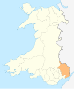
Location within Monmouthshire
- Monmouthshire
- Gwent
- Monmouth
- List of places
- UK
- Wales
- Monmouthshire
Llangattock Lingoed (Welsh: Llangatwg Lingoed) is a small rural village in Monmouthshire, south east Wales. It is located approximately five miles north of Abergavenny, between Abergavenny and Grosmont, a few miles south of the Wales-England border. Offa's Dyke Path passes through the village. The village is near the Black Mountains and the Brecon Beacons National Park.
Amenities and history
The parish church is St Cadoc's and both the village and the church have a long and interesting history sandwiched as they are in the Welsh Marches between border castles and the historical personalities holding sway at any given time.[1]
The Old Court is a Grade II* listed building situated in the village.[2]
The Cistercian Way long distance footpath that circumnavigates all of Wales also passes through the village.
References
- ^ St. Cadoc's church history Archived 2007-09-24 at the Wayback Machine
- ^ Good Stuff (5 June 1952). "Old Court including Former Cider House, Granary and Stable Range - Grosmont - Monmouthshire - Wales". British Listed Buildings. Retrieved 26 February 2017.
External links
- The parish name
- Map sources for Llangattock Lingoed
- v
- t
- e
- Bedwellty
- Betws Newydd
- Black Rock
- Blaenawey
- The Bryn
- Bryngwyn
- Buckholt
- Botany Bay
- Catbrook
- Caer Llan
- Caerwent
- Chapel Hill
- Clydach
- Coed Morgan
- Coed-y-paen
- Crick
- Croes y pant
- Croes Hywel
- Cross Ash
- Crossway
- Cwmcarvan
- Cwmyoy
- Devauden
- Dingestow
- Dixton
- Earlswood
- Gaerllwyd
- Gilwern
- Glascoed
- Goetre
- Govilon
- Great Oak
- Grosmont
- Gwehelog
- Gwernesney
- Highmoor Hill
- Hoaldalbert
- Itton
- Kemeys Commander
- Kilgwrrwg Common
- Kingcoed
- Little Mill
- Llanarth
- Llanbadoc
- Llancayo
- Llanddewi Rhydderch
- Llandewi Skirrid
- Llandegveth
- Llandenny
- Llandevenny
- Llandogo
- Llanellen
- Llanelly
- Llanfair Kilgeddin
- Llanfihangel Rogiet
- Llanfihangel Crucorney
- Llanfoist
- Llangattock-Lingoed
- Llangattock-Vibon-Avel
- Llangovan
- Llangua
- Llangwm-isaf
- Llangybi
- Llanhennock
- Llanishen
- Llanllowell
- Llanover
- Llansoy
- Llanthony
- Llantilio Crossenny
- Llantilio Pertholey
- Llantrisant
- Llanvair-Discoed
- Llanvapley
- Llanvetherine
- Llanwenarth
- Llanvihangel-Ystern-Llewern
- Llanvihangel Gobion
- Magor
- Mamhilad
- Mardy
- Maryland
- Mathern
- Maypole
- Mitchel Troy
- Mitcheltroy Common
- Monkswood
- Mounton
- Mynydd-bach
- Mynyddislwyn
- Nant-y-derry
- The Narth
- New Inn
- New Mills
- Newbridge-on-Usk
- Newcastle
- Newchurch
- Oldcastle
- Pandy
- Parkhouse
- Pen-croes-oped
- Pen-how
- Pen-yr-hoel
- Pen-y-cae-mawr
- Pen-y-clawdd
- Pen-twyn
- Penallt
- Penpergwm
- Penperlleni
- Penrhos
- Portskewett
- Pwllmeyric
- Raglan
- Redbrook
- Redwick
- Rockfield
- Rogiet
- St Arvans
- St Brides Netherwent
- St Maughans
- Shirenewton
- Skenfrith
- Sudbrook
- Tintern
- Tredunnock
- Tregagle
- Tregare
- Trelleck Grange
- Trelleck
- Twyn-y-Sheriff
- Undy
- Upper Green
- Wernyrheolydd
- Whitebrook
- Whitson
- Wilcrick
- Wolvesnewton
- Wonastow
- Wyesham
- Abergavenny Castle
- Betws newydd
- Caerleon
- Caldicot Castle
- Castell Arnold
- Chepstow Castle
- Dingestow
- Grosmont Castle
- Llangibby
- Llanfair Kilgeddin
- Llantrisant
- Llanvair Discoed
- Monmouth
- Newport Castle
- Newcastle
- Penhow
- Pencoed Castle
- Pen y Clawdd Castle
- Penrhos
- Raglan Castle
- Skenfrith Castle
- Trellech
- Usk Castle
- White Castle
- Parliamentary constituencies
- Places
- Schools
- SSSIs
- Listed buildings
- Scheduled Monuments
- Registered parks and gardens
- Country houses
- Lord Lieutenants
- High Sheriffs
- Museums
- Cuisine
 Geography
 Wales
Wales


Authority control databases | |
|---|---|
| International |
|
| National |
|
 | This article relating to a location in Monmouthshire is a stub. You can help Wikipedia by expanding it. |
- v
- t
- e


