Khinjan District
District in Baghlan, Afghanistan
Khinjan خِنجان | |
|---|---|
District | |
 Khinjan mountains overview | |
| 35°28′12″N 68°58′12″E / 35.47000°N 68.97000°E / 35.47000; 68.97000 | |
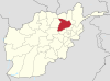
| Country |  Afghanistan Afghanistan |
| Province | Baghlan |
| Elevation | 1,050 m (3,440 ft) |
| Population (2012) | |
| • Total | 29,600 |
| Time zone | +4:30 |
Khinjan District (pop: 29,600)[2] is located in the southern part of Baghlan province in the Hindu Kush mountains. The capital is the town of Khenjan. The main Kabul-Kunduz highway passes through the district from south to west. Ethnic Tajiks makes up around 85% of the total population while the Pashtuns, Hazara and Uzbeks, each at 5%, makes up the remaining 15% of the population.[3]
See also
- Districts of Afghanistan
- Baghlan Province
References
- ^ "District Names". National Democratic Institute. Archived from the original on 29 January 2016. Retrieved 9 July 2015.
- ^ "Settled Population of Baghlan province by Civil Division , Urban, Rural and Sex-2012-13" (PDF). Central Statistics Organization. Archived from the original (PDF) on 26 February 2014. Retrieved 9 July 2015.
- ^ "Archived copy" (PDF). www.aims.org.af. Archived from the original (PDF) on 17 May 2011. Retrieved 13 January 2022.
{{cite web}}: CS1 maint: archived copy as title (link)
External links
- Map
- District profile by the UNHCR (9 April 2002)
 | This Baghlan Province, Afghanistan location article is a stub. You can help Wikipedia by expanding it. |
- v
- t
- e


