Kamdesh District
District in Nuristan Province, Afghanistan
35°29′00″N 71°19′00″E / 35.48333°N 71.31667°E / 35.48333; 71.31667 Afghanistan
 (2010)
Kamdesh District[2] (Kamdeish District, Pashto: کامدېش ولسوالۍ, Persian: ولسوالی کامدیش) is a district of Nuristan Province in eastern Afghanistan,[3] sharing a name with the town of Kamdesh. It was originally in Kunar Province[4] and then was moved to the newly created Nuristan Province in 2001.
Boundaries
Since March 2004, Kamdesh District borders on:[3]
- Bargi Matal District to the north,
- Pakistan to the east,
- Ghaziabad District and Nari District of Kunar Province to the south,
- Waygal District to the southwest, and
- Parun District to the west.
See also
- Battle of Kamdesh, 2009
- Kom people
Notes
- ^ "Nuristan Provincial Profile" (PDF). Minister of Rural Rehabilitation and Development. Retrieved 27 August 2015.
- ^ Kāmdēsh (Approved) at GEOnet Names Server, United States National Geospatial-Intelligence Agency
- ^ a b "Afghanistan Administrative Divisions" Archived 2010-09-23 at the Wayback Machine map, March 2007, Afghanistan Information Management Services (AIMS)
- ^ "Afghanistan" political map, 1986, United States Central Intelligence Agency
External links
- Map of Natural Hazards & Settlements iMMap
- v
- t
- e
| ||
|---|---|---|
| Districts | 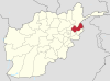 | |
| Populated places | ||
| Other | ||
 | This Nuristan Province, Afghanistan location article is a stub. You can help Wikipedia by expanding it. |
- v
- t
- e


