Gülağaç District
District in Aksaray, Turkey
38°24′N 34°21′E / 38.400°N 34.350°E / 38.400; 34.350 (2021)
Gülağaç District is a district of Aksaray Province of Turkey. Its seat is the town Gülağaç.[1] Its area is 326 km2,[2] and its population is 19,443 (2021).[3]
Composition
There are 4 municipalities in Gülağaç District:[1][4]
There are 9 villages in Gülağaç District:[5]
Places of interest
The underground city of Kırkgöz in the town of Saratlı. The underground city of Çukurören in the town of Gülpınar.
References
- ^ a b İlçe Belediyesi, Turkey Civil Administration Departments Inventory. Retrieved 12 January 2023.
- ^ "İl ve İlçe Yüz ölçümleri". General Directorate of Mapping. Retrieved 12 January 2023.
- ^ "Address-based population registration system (ADNKS) results dated 31 December 2021" (XLS) (in Turkish). TÜİK. Retrieved 12 January 2023.
- ^ Belde Belediyesi, Turkey Civil Administration Departments Inventory. Retrieved 16 January 2023.
- ^ Köy, Turkey Civil Administration Departments Inventory. Retrieved 15 January 2023.
- v
- t
- e
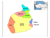
Gülağaç District in Aksaray Province of Turkey

| Istanbul | |
|---|---|
| West Marmara | |
| Aegean | |
| East Marmara | |
| West Anatolia | |
| Mediterranean | |
| Central Anatolia | |
| West Black Sea | |
| East Black Sea | |
| Northeast Anatolia | |
| Central East Anatolia | |
| Southeast Anatolia | |
Metropolitan municipalities are bolded.
 Gülağaç District Gülağaç District | |
|---|---|
| Municipalities | |
| Villages | |
 | This geographical article about a location in Aksaray Province, Turkey is a stub. You can help Wikipedia by expanding it. |
- v
- t
- e


