Fridhemsplan metro station
Stockholm Metro station
59°19′57″N 18°01′50″E / 59.33250°N 18.03056°E / 59.33250; 18.03056| Preceding station |  Stockholm metro Stockholm metro | Following station | ||
|---|---|---|---|---|
| Rådhuset towards Kungsträdgården | Line 10 | Stadshagen towards Hjulsta | ||
| Line 11 | Stadshagen towards Akalla | |||
| Thorildsplan towards Åkeshov | Line 17 | St. Eriksplan towards Skarpnäck | ||
| Thorildsplan towards Alvik | Line 18 | St. Eriksplan towards Farsta strand | ||
| Thorildsplan towards Hässelby strand | Line 19 | St. Eriksplan towards Hagsätra | ||
Location | |
|---|---|
  |
Fridhemsplan metro station is a station of the Stockholm metro, located in the district of Kungsholmen. The station is entirely underground and provides an interchange between the Blue and Green lines. There are two platforms for each line, about a hundred metres apart.
To the south-west of the station a tunnel between the blue and green lines provides the only connection for trains to be moved onto and off the blue line.
The green line platforms were opened on 26 October 1952 as a part of the stretch between Hötorget and Vällingby.[2] and are around 18 m (59 ft) under the ground. The distance to Slussen is 4.9 km (3.0 mi). The second part was opened on 31 August 1975 as part the first stretch of the Blue Line between T-Centralen and Hjulsta. The trains were running via Hallonbergen and Rinkeby.[2] The blue line platform is around 28–31 meters under the ground. The distance to Kungsträdgården is 2.1 km (1.3 mi).
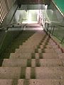
Gallery


See also
References
- ^ a b c "Fakta om SL och regionen 2019" (PDF) (in Swedish). Storstockholms Lokaltrafik. pp. 51, 66. Archived (PDF) from the original on 27 December 2020. Retrieved 29 March 2021.
- ^ a b Schwandl, Robert. "Stockholm". urbanrail.
External links
- Images of Fridhemsplan
- v
- t
- e

| Shared stations | |
|---|---|
| 17 | |
| 18 |
|
| 19 |


| |||||||||||||
|---|---|---|---|---|---|---|---|---|---|---|---|---|---|
| Stations |
| ||||||||||||
| Authority control databases: Geographic |
|
|---|
 | This article about a Swedish railway station is a stub. You can help Wikipedia by expanding it. |
- v
- t
- e
 | This Stockholm Metro article is a stub. You can help Wikipedia by expanding it. |
- v
- t
- e


