Santa Rosa, New Mexico
| Santa Rosa | |
| city | |
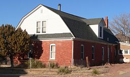 Julius J. Moise House | |
| Land |  USA USA |
|---|---|
| Delstat | New Mexico |
| County | Guadalupe County |
| Höjdläge | 1 407 m ö.h. |
| Koordinater | 34°56′19″N 104°40′57″V / 34.93861°N 104.68250°V / 34.93861; -104.68250 |
| Yta | 13 km² (2010) |
| - land | 13 km² |
| - vatten | 0 km² |
| Folkmängd | 2 850 (2020)[1] |
| Befolkningstäthet | 219 invånare/km² |
| Tidszon | MST (UTC-7) |
| - sommartid | MDT (UTC-6) |
| ZIP-kod | 87435 |
| Riktnummer | 575 |
| FIPS | 3570670 |
| Geonames | 5490338 |
  Ortens läge i New Mexico | |
 New Mexicos läge i USA | |
| Webbplats: santarosanm.org | |
Santa Rosa är administrativ huvudort i Guadalupe County i New Mexico.[2][3][4] Enligt 2020 års folkräkning hade Santa Rosa 2 850 invånare.[1]
Källor
- ^ [a b] ”Santa Rosa city, New Mexico 2020 Decennial Census” (på engelska). United States Census Bureau. https://data.census.gov/profile/Santa_Rosa_city,_New_Mexico?g=160XX00US3570670. Läst 14 april 2023.
- ^ New Mexico County Map with County Seat Cities. Geology.com Geoscience News and Information. Läst 31 maj 2017.
- ^ Santa Rosa, NM. Map Quest. Läst 31 maj 2017.
- ^ Profile for Santa Rosa, New Mexico Arkiverad 26 juni 2017 hämtat från the Wayback Machine.. ePodunk. Läst 31 maj 2017.
Bilder & media
|


