Berlin-Baumschulenweg

Cet article est une ébauche concernant Berlin.
Vous pouvez partager vos connaissances en l’améliorant (comment ?) selon les recommandations des projets correspondants.
| Berlin-Baumschulenweg | |||
 La gare S-Bahn de Berlin-Baumschulenweg. | |||
| Administration | |||
|---|---|---|---|
| Pays |  Allemagne Allemagne | ||
| Région | Berlin | ||
| Ville | Berlin | ||
| Arrondissement municipal | Treptow-Köpenick | ||
| Code postal | 12437 | ||
| Démographie | |||
| Population | 18 889 hab. (31/12/2021) | ||
| Densité | 3 919 hab./km2 | ||
| Géographie | |||
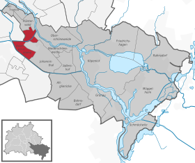
| Coordonnées | 52° 27′ 54″ nord, 13° 29′ 10″ est | ||
| Altitude | 34 m | ||
| Superficie | 482 ha = 4,82 km2 | ||
| Localisation | |||
 | |||
| Géolocalisation sur la carte : Berlin
Géolocalisation sur la carte : Allemagne
| |||
modifier  | |||


Berlin-Baumschulenweg [ˈbaʊ̯mʃuːlənˌveːk] Écouter est un quartier à Berlin, situé dans l'arrondissement de Treptow-Köpenick. Le quartier a été incorporé à Berlin le . Entre 1920 et 2001, il faisait partie du district de Treptow.
Population
Le quartier comptait 18 293 habitants le selon le registre des déclarations domiciliaires[1], c'est-à-dire 3 795 hab./km2.
Notes et références
- ↑ (de) « Einwohnerinnen und Einwohner am Ort der Hauptwohnung in Berlin am 31.12.2016 nach Ortsteilen und Altersgruppen » [PDF], sur Amt für Statistik Berlin-Brandenburg,
v · m | ||
|---|---|---|
| Arrondissements | Quartiers |  |
| Mitte (01) | ||
| Friedrichshain-Kreuzberg (02) | ||
| Pankow (03) | ||
| Charlottenbourg-Wilmersdorf (04) | ||
| Spandau (05) | ||
| Steglitz-Zehlendorf (06) | ||
| Tempelhof-Schöneberg (07) | ||
| Neukölln (08) | ||
| Treptow-Köpenick (09) | ||
| Marzahn-Hellersdorf (10) | ||
| Lichtenberg (11) | ||
| Reinickendorf (12) | ||
 Portail de Berlin


