Zakal
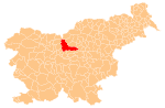
Place in Upper Carniola, Slovenia
46°15′49.82″N 14°34′37.55″E / 46.2638389°N 14.5770972°E / 46.2638389; 14.5770972 Slovenia
 (2002)
Zakal (pronounced [zaˈkaːu̯]) is a dispersed settlement in the hills northwest of Kamnik in the Upper Carniola region of Slovenia.
Name
Zalak was attested in written records as Zachalom in 1457.[2][3]
Church

The local church, dedicated to Saint Leonard, is an example of a medieval church with a flat ceiling and two gilded altars.[4]
References
External links
 Media related to Zakal at Wikimedia Commons
- Zakal on Geopedia
- v
- t
- e
Municipality of Kamnik
Administrative seat: Kamnik
- Big Pasture Plateau
- Kamnik Bistrica Valley
- Kamnik Parish Church
- Little Castle
- Menina Pasture Plateau
- Nevljica
- Snovik Spa
- St. Primus' Church
- Tuhinj Valley
- Tunjice Natural Health Resort
- Volčji Potok Arboretum
- Zaprice Castle


