Yellow Quill 90-10
Indian reserve in Saskatchewan, Canada
Indian reserve in Canada, Yellow Quill
Yellow Quill 90-10 | |
|---|---|
Indian reserve | |
| Yellow Quill Indian Reserve No. 90-10 | |
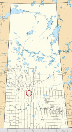 Location in Saskatchewan | |
| First Nation | Yellow Quill |
| Country | Canada |
| Province | Saskatchewan |
| Area | |
| • Total | 0.2 ha (0.5 acres) |
Yellow Quill 90-10 is an Indian reserve of the Yellow Quill First Nation in Saskatchewan.[1][2]
See also
References
- ^ a b "Reserve/Settlement/Village Detail". Crown–Indigenous Relations and Northern Affairs Canada. Government of Canada. 14 November 2008. Retrieved 12 August 2019.
- ^ "Canada Lands Survey System - CLSS Map Browser". Natural Resources Canada. 13 December 2013. Retrieved 9 October 2019.
- v
- t
- e
- Cree
- Plains
- Swampy
- Woodland
- Dakota
- Dene
- Nakota
- Saulteaux
band governments
| Agency Chiefs Tribal Council (Spiritwood) | |
|---|---|
| Battlefords Agency Tribal Chiefs (North Battleford) | |
| Battlefords Tribal Council (North Battleford) | |
| File Hills Qu'Appelle Tribal Council (Fort Qu'Appelle) | |
| Meadow Lake Tribal Council (Meadow Lake) | |
| Prince Albert Grand Council (Prince Albert) | |
| Saskatoon Tribal Council (Saskatoon) | |
| Touchwood Agency Tribal Council (Punnichy) | |
| Yorkton Tribal Administration (Yorkton) | |
| Unaffiliated | |
| Not federally recognized |
| ||
|---|---|---|
| Cities |  | |
| Towns | ||
| Villages | ||
| Resort villages | ||
| Rural municipalities | ||
| First Nations | ||
| Indian reserves | ||
| Unincorporated communities | ||
52°07′31″N 106°39′40″W / 52.1252°N 106.6612°W / 52.1252; -106.6612 (Yellow Quill 90-10)
 | This article about an Indian reserve in Saskatchewan is a stub. You can help Wikipedia by expanding it. |
- v
- t
- e


