Wattenberg, Tyrol
Place in Tyrol, Austria

Coat of arms
(2018-01-01)[2]
6113
Wattenberg is a municipality in the district of Innsbruck-Land in the Austrian state of Tyrol located 15 km east of Innsbruck and 2.50 km above the Swarovski crystal town Wattens.
Population
| Year | Pop. | ±% |
|---|---|---|
| 1869 | 380 | — |
| 1880 | 373 | −1.8% |
| 1890 | 341 | −8.6% |
| 1900 | 394 | +15.5% |
| 1910 | 402 | +2.0% |
| 1923 | 425 | +5.7% |
| 1934 | 430 | +1.2% |
| 1939 | 523 | +21.6% |
| 1951 | 498 | −4.8% |
| 1961 | 442 | −11.2% |
| 1971 | 486 | +10.0% |
| 1981 | 518 | +6.6% |
| 1991 | 562 | +8.5% |
| 2001 | 715 | +27.2% |
| 2011 | 721 | +0.8% |
Gallery
-
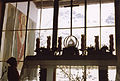
 Wattenberg.
 -
-
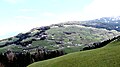 Wattenberg Tyrol.


References
External links
Wikimedia Commons has media related to Wattenberg.
- Municipality Wattenberg: Official website of the municipality in the Hall-Wattens region
- v
- t
- e
Municipalities in the district of Innsbruck-Land
- Absam
- Aldrans
- Ampass
- Axams
- Baumkirchen
- Birgitz
- Ellbögen
- Flaurling
- Fritzens
- Fulpmes
- Gnadenwald
- Götzens
- Gries am Brenner
- Gries im Sellrain
- Grinzens
- Gschnitz
- Hall in Tirol
- Hatting
- Inzing
- Kematen in Tirol
- Kolsass
- Kolsassberg
- Lans
- Leutasch
- Matrei am Brenner
- Mieders
- Mils
- Mutters
- Natters
- Navis
- Neustift im Stubaital
- Oberhofen im Inntal
- Obernberg am Brenner
- Oberperfuss
- Patsch
- Pettnau
- Pfaffenhofen
- Polling in Tirol
- Ranggen
- Reith bei Seefeld
- Rinn
- Rum
- St. Sigmund im Sellrain
- Scharnitz
- Schmirn
- Schönberg im Stubaital
- Seefeld in Tirol
- Sellrain
- Sistrans
- Steinach am Brenner
- Telfes
- Telfs
- Thaur
- Trins
- Tulfes
- Unterperfuss
- Vals
- Volders
- Völs
- Wattenberg
- Wattens
- Wildermieming
- Zirl

Authority control databases | |
|---|---|
| International |
|
| National |
|
 | This Tyrol location article is a stub. You can help Wikipedia by expanding it. |
- v
- t
- e


