Wadbilliga River
River in New South Wales, Australia
| Wadbilliga River | |
|---|---|
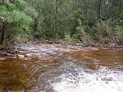 Wadbilliga River, in Wadbilliga National Park, 2011 | |
| Location | |
| Country | Australia |
| State | New South Wales |
| Region | South East Corner (IBRA), South Coast |
| Municipality | Bega Valley |
| Physical characteristics | |
| Source | Kybeyan Range, Great Dividing Range |
| • location | West of Cobargo |
| • elevation | 668 m (2,192 ft) |
| Mouth | Confluence with the Tuross River |
• location | East of the locale of Belowa |
• elevation | 73 m (240 ft) |
| Length | 33.8 km (21.0 mi) |
| Basin features | |
| River system | Tuross River |
| Tributaries | |
| • right | Queens Pound River, Lake Creek (New South Wales), Yowrie River, Brassknocker Creek |
| National park | Wadbilliga |
| [1] | |
The Wadbilliga River is a perennial stream[2] of the Tuross River catchment that is located in the South Coast region of New South Wales, Australia.
Course and features
The Wadbilliga River rises on the western slopes of Mount Wadbilliga, located within Wadbilliga National Park and part of the Kybeyan Range, within the Great Dividing Range. The river flows generally north, east northeast, east by south, and then northeast, before reaching its confluence with the Tuross River,[2] east of the locale of Belowa. The river descends 594 metres (1,949 ft) over its 33.8 kilometres (21.0 mi) course.[1]
See also
 New South Wales portal

- List of rivers of Australia
- List of rivers of New South Wales (L–Z)
- Rivers of New South Wales
References
- ^ a b "Map of Wadbilliga River, NSW". Bonzle Digital Atlas of Australia. Retrieved 15 May 2013.
- ^ a b "Wadbilliga River". Geographical Names Register (GNR) of NSW. Geographical Names Board of New South Wales. Retrieved 15 May 2013.

External links
- "Tuross River catchment" (map). Office of Environment and Heritage. Government of New South Wales.
- v
- t
- e
Rivers of the Southern Rivers catchment, New South Wales, Australia
- Lake Illawarra
- Minnamurra
- Port Kembla
- Corang
- Endrick
- Jerrabattgulla
- Kangaroo
- Mongarlowe
- Shoalhaven
- St Georges Basin
- Crooked
- Araluen
- Back
- Bettowynd
- Bimberamala
- Buckenbowra
- Clyde
- Deua
- Moruya
- Queens Pound
- Tomaga
- Tuross
- Wadbilliga
- Yadboro
- Yowaka
- Yowrie
 Category

| |
|---|---|
| Cities | |
| Towns & Townships |
|
| Local government areas | |
| National parks | |
| Rivers and other waterbodies |
|

36°12′S 149°46′E / 36.200°S 149.767°E / -36.200; 149.767


