Vulcan County
Municipal district in Alberta, Canada
Municipal district in Alberta, Canada

Vulcan

Arrowwood
Carmangay
Champion
Lomond
Milo

Brant
Ensign
Herronton
Kirkcaldy
Mossleigh
Queenstown
Shouldice
Travers

Location within Alberta
(2021)[2]
(2021)[2]
Vulcan County is a municipal district in Alberta, Canada. Located in Census Division No. 5, its municipal office is located in the Town of Vulcan.
History
Vulcan County was originally established in 1951.
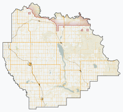
Geography
Communities and localities
| The following urban municipalities are surrounded by Vulcan County.[3]
| The following hamlets are located within Vulcan County.[3]
|
The following localities are located within Vulcan County.[4]
- Localities
- Other places
Demographics
In the 2021 Census of Population conducted by Statistics Canada, Vulcan County had a population of 4,237 living in 1,206 of its 1,640 total private dwellings, a change of 6.4% from its 2016 population of 3,984. With a land area of 5,356.65 km2 (2,068.21 sq mi), it had a population density of 0.8/km2 (2.0/sq mi) in 2021.[2]
In the 2016 Census of Population conducted by Statistics Canada, Vulcan County had a population of 3,984 living in 1,180 of its 1,616 total private dwellings, a 2.8% change from its 2011 population of 3,875. With a land area of 5,433.43 km2 (2,097.86 sq mi), it had a population density of 0.7/km2 (1.9/sq mi) in 2016.[7]
Vulcan County's 2012 municipal census counted a population of 3,893,[8] a 0.5% increase over its 2007 municipal census population of 3,830.[9]
See also
Wikimedia Commons has media related to Vulcan County, Alberta.
References
- ^ "Municipal Officials Search". Alberta Municipal Affairs. May 9, 2019. Retrieved October 1, 2021.
- ^ a b c "Population and dwelling counts: Canada, provinces and territories, and census subdivisions (municipalities)". Statistics Canada. February 9, 2022. Retrieved February 9, 2022.
- ^ a b "Specialized and Rural Municipalities and Their Communities" (PDF). Alberta Municipal Affairs. January 12, 2022. Retrieved January 21, 2022.
- ^ "Standard Geographical Classification (SGC) 2006, Economic Regions: 4805001 - Vulcan County, geographical codes and localities, 2006". Statistics Canada. March 5, 2010. Retrieved August 12, 2012.
- ^ Forgotten Alberta - Kinnondale
- ^ Ghost towns Canada - Waldeck
- ^ "Population and dwelling counts, for Canada, provinces and territories, and census subdivisions (municipalities), 2016 and 2011 censuses – 100% data (Alberta)". Statistics Canada. February 8, 2017. Retrieved February 8, 2017.
- ^ "Vulcan County Integrated Community Sustainability Plan". Vulcan County. 2012. Retrieved November 24, 2012.
- ^ "Alberta 2009 Official Population List" (PDF). Alberta Municipal Affairs. September 15, 2009. Retrieved September 14, 2010.
External links
- Official website

Places adjacent to Vulcan County | |
|---|---|


- v
- t
- e
Subdivisions of Alberta
service areas
municipalities
municipalities
- Crowsnest Pass, Municipality of
- Jasper, Municipality of
- Lac La Biche County
- Mackenzie County
- Strathcona County
- Wood Buffalo, Regional Municipality of
 Category
 Canada portal
 WikiProject


