University, Denver

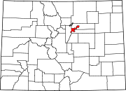
University is a neighborhood in Denver, Colorado. It is home to the University of Denver, many university students, and other residents and businesses, including the first Chipotle Mexican Grill.
Geography
University is a neighborhood as defined by the city of Denver. The boundaries of university are the following:
- North – Interstate 25
- West – Downing Street
- East – University Boulevard
- South – Denver/Englewood Boundary
References
- City and County of Denver map specifying University Neighborhood boundaries, Accessed May 2, 2008
- Part of the University of Denver campus in the University Neighborhood in Denver
39°40′26″N 104°58′01″W / 39.67400°N 104.96708°W / 39.67400; -104.96708
- v
- t
- e
Neighborhoods of the City and County of Denver
- Auraria
- Capitol Hill
- Civic Center (aka Golden Triangle)
- Central Business District
- Five Points (RiNo)
- Lincoln Park
- North Capitol Hill
- Union Station

- Clayton
- Cole
- Elyria-Swansea
- Globeville
- Whittier
- Central Park
- City Park West
- Denver International Airport
- Gateway
- Green Valley Ranch
- Montbello
- North Park Hill
- Northeast Park Hill
- South Park Hill
- Skyland
- Berkeley
- Chaffee Park
- East Highlands
- Highland
- Jefferson Park
- Regis
- Sunnyside
- West Highlands
- Baker
- College View
- Overland
- Platte Park
- Rosedale
- Ruby Hill
- Southmoor Park
- Speer
- University
- University Hills
- University Park
- Washington Park
- Washington Park West
- Wellshire
- Country Club
- Goldsmith
- Hampden
- Hampden South
- Kennedy
- Belcaro
- Cherry Creek
- Cheesman Park
- City Park
- Congress Park
- Cory-Merrill
- Crestmoor
- East Colfax
- Hale
- Hilltop
- Indian Creek
- Lowry
- Montclair
- Virginia Village
- Washington Virginia Vale
- Windsor
- Athmar Park
- Barnum
- Barnum West
- Harvey Park
- Mar Lee
- Sloan Lake
- Sun Valley
- Valverde
- Villa Park
- West Colfax
- Westwood
- Alamo Placita
- Curtis Park
- LoDo
- List
- Category
 | This Denver-related article is a stub. You can help Wikipedia by expanding it. |
- v
- t
- e


