Hong Kong, Macau, Philippines, South China, Taiwan, Vietnam
IBTrACS
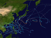
Part of the 2017 Pacific typhoon season
Typhoon Hato, known in the Philippines as Severe Tropical Storm Isang, was a strong tropical cyclone that struck South China in August 2017.[nb 1] The thirteenth named storm and the fourth typhoon of the Pacific typhoon season, Hato formed as a tropical depression over the east of Luzon on 19 August. The system further developed and became a tropical storm the next day. On 21 August, Hato emerged over the northern portion of the South China Sea and reached typhoon intensity. Rapid intensification ensued on 23 August, and Hato became a Category 3-equivalent typhoon before making landfall over Jinwan, Zhuhai. The storm further weakened over land and dissipated on 24 August.
One of the strongest typhoons to impact Macau and Hong Kong in the past 50 years, Hato caused significant damage totaling US$6.82 billion along its path. The bulk of the losses were incurred in Mainland China, where Hato brought a storm surge that caused severe flooding in several provinces along the Pearl River, in addition to wind gusts that reached 240 km/h (150 mph). Both Hong Kong and Macau had their tropical cyclone signals raised to the highest category in anticipation of the storm, which inflicted more than US$1 billion worth of damage in each of those areas. Also, while weakening, Hato brought heavy rain and a tornado to Vietnam. A total of 24 fatalities occurred due to Hato.
Hato made landfall along the southern coast of Zhuhai with a Category-3 intensity (both 1-min and 2-min sustained wind speed of 185 km/h), strong but not stronger than other more powerful storms. Three other major typhoons, Wanda (1962), Ruby (1964), and Vicente (2012), followed a similar trajectory as that of Hato (from ESE to WNW), making landfall on slightly different parts of the coast. Hato's forward speed was the fastest of these typhoons, reaching 32.5 km/h (20.2 mph), nearly twice as fast as the speed of Wanda.[1]
During the late hours of 18 August, the Joint Typhoon Warning Center (JTWC) started to monitor a tropical disturbance that had developed about 1,495 km (930 mi) southeast of Taipei, Taiwan.[2] By 19 August, the Japan Meteorological Agency (JMA) began to monitor the area of low-pressure as a tropical depression.[3] Around the same time, the JTWC issued a Tropical Cyclone Formation Alert (TCFA),[4] while the JMA initiated advisories as it was determined that the system had 10-minute sustained winds of 55 km/h (35 mph).[5] By 03:00 UTC on 20 August, the JTWC began issuing advisories, designating the system as a tropical depression with the numerical designation of 15W.[6] The PAGASA named 15W as Isang, as system was already a tropical cyclone and was located within their area of responsibility.[7] Six hours later, the JMA upgraded the system to a tropical storm, assigning the name Hato.[8]
At 15:00 UTC of 20 August, the JTWC upgraded Hato to a tropical storm after the storm further organized.[9] By this time, Hato was located in a favorable environment with low vertical wind shear and sea-surface temperatures (SSTs) of 30 °C (86 °F).[10] Hato failed to strengthen throughout most of 21 August due to a partially exposed low-level circulation center (LLCC) with sheared convection.[11] Several hours later, the system's LLCC became broad as convection began to develop.[12] By 22 August, SSTs near the storm rose to 31 °C (87.8 °F),[13] therefore the JMA had upgraded Hato to a severe tropical storm.[14] The system had rapidly consolidated as it formed a 20-nm diameter eye, including a significant improved convective structure with tightly curved banding flowing into the systems LLCC.[15] Both agencies upgraded Hato to a typhoon six hours later,[16] despite its eye losing its structure.[17]
Early on 23 August, the JTWC upgraded Hato to a Category 2 typhoon after its eye began to reform with a central dense overcast.[18] Hato reached its peak intensity as a Category 3-equivalent typhoon with Dvorak estimates reaching T5.5.[2] The JMA estimated peak 10-minute sustained winds of 150 km/h (90 mph) with a minimum barometric pressure of 960 hPa, which was revised to 140 km/h and 965 hPa during post-analysis.[19] However, a minimum pressure of 945 hPa was recorded in Macau, and the CMA estimated a minimum pressure of 935 hPa, suggesting that its intensity was higher.[20] Hato made landfall over the southern coast of Zhuhai, Guangdong at 12:50 CST (04:50 UTC).[21] About three hours later, the JTWC issued its final warning on Hato as the storm moved further inland.[22] Six hours later, the JMA downgraded Hato to a severe tropical storm,[23] then to a tropical storm.[24] The JMA continued to track Hato until 06:00 UTC on 24 August.[25]
A storm surge of 500–1,300 mm (20–51 in) from the Pearl River inundated the provinces of Guangdong, Guangxi, Yunnan, Fujian and Guizhou.[27] Peak winds of 66.9 m/s (241 km/h) were observed in the city of Guishan, Zhuhai, the strongest wind ever recorded there.[27] 267 people were hurt and sent to hospital, including 10 people who sustained serious injuries.[27] 256 members of the public were stranded and had to be rescued.[27] In total, 32 people were killed while total damages in Mainland China were counted to CN¥28.91 billion (US$4.34 billion).[34]
Hong Kong
Typhoon Hato making landfall over Jinwan, Zhuhai on August 23
For the first time in five years, since Typhoon Vicente in 2012, the Hong Kong Observatory issued the Hurricane Signal, No.10, which is the highest level of tropical cyclone warning signals in Hong Kong.[35] Owing to the typhoon, the Hong Kong Observatory recorded a record-breaking temperature of 36.6 °C (97.9 °F). It is the highest record in 132 years.[36] The Air Quality Health Index has also reached level 8 in a lot of Air Quality Monitoring Stations.[37] Consequently, Hong Kong saw the closure of businesses, government offices, schools, courts and the stock market. At least 121 cases of injury were reported due to the passage of the storm.[29] Major damage to property, such as broken windows and collapsed scaffolding, were widely reported, with more than 692 reports of fallen trees, debris, displaced bins, and glass shards littering the pavements and major roads.[38] Serious flooding were reported in low-lying areas, such as Heng Fa Chuen on Hong Kong Island, Lei Yue Mun and Tai O due to storm surge.[39] More than 450 flights were cancelled or delayed at Hong Kong International Airport and public transport was brought to a standstill.[40] The estimated economic cost was around HK$4 billion (US$511 million).[28]
Macau
Street flooding in Macau
The storm was the strongest to have hit Macau in 53 years, according to Macau's Chief ExecutiveFernando Chui, and it was the first time in 18 years that the Macao Meteorological and Geophysical Bureau hoisted a No. 10 tropical cyclone signal.[41] Maximum hourly mean winds of 132 km/h (82 mph) and gusts of 217 km/h (135 mph) were the highest on record in Macau.[42] Most areas of the territory was hit by major flooding and property damages, with citywide power and water outage lasting for at least 24 hours after the passage of the storm. Overall, 10 deaths and at least 200 injuries were reported.[32] The head of the Macao Meteorological and Geophysical Bureau resigned due to criticisms by the Macanese public that officials failed to predict the ferocity of the storm. The Corruption Agency is investigating The Meteorology Bureau's forecasting procedures and management, including the former director Fong Soi-Kun.[43] The Macau SAR Government also announced 1.3 billion Macanese patacas would be set aside for those affected by the typhoon, with families of victims to get up to 300,000 patacas (US$37 thousand) each.[44] In total, Macau suffered an economic loss of 12.55 billion patacas (US$1.56 billion).[31]
There were shortages of basic supplies locally due to residents buying up remaining stocks in response to the utilities shortages and flooding.[45] At the request of the local government, the Chinese People's Liberation Army Macau Garrison was deployed to assist in disaster relief and cleaning up for the first time in Macau history.[46] About 1,000 troops were called in to help remove debris and clear roads.[citation needed] Macau police arrested two people for using phone to spread unverified information alleging that the authorities had sought to cover up the discovery of bodies in a car park during Typhoon Hato.[47]
A typhoon and storm surge coupling model demonstrated that the maximum storm surge height reached nearly 2.5 m (8.2 ft) along the coast of Macau, while that in Hong Kong was slightly below 2 m (6.6 ft). Furthermore, a field survey of urban flooding revealed evidence of a 2.25-m inundation in downtown Macau and a 0.55-m inundation on Lantau Island, Hong Kong, which were likely exacerbated by a combination of storm surge, heavy rainfall, and surface water runoff over a complex hilly terrain.[1]
Vietnam
Despite passing well to the north of Vietnam, the storm triggered heavy rainfall and a tornado in Lào Cai, Vietnam on 23 August. More than 754 houses were damaged in Sa Pa, which injured one person.[48] Strong winds damaged about 90 ha (220 acres) of rice crops which included 37 ha (91 acres) of corn.[48][49] The storm killed one person and total damage reached 7 billion₫ (US$308 thousand).[48] Total damage in Vietnam from the remnants of Hato reached 31 billion₫ (US$1.36 million).[33]
Retirement
Due to the extensive damage and high death toll in South China, the name Hato was officially retired during the 50th annual session of the ESCAP/WMO Typhoon Committee in February 2018. In February 2019, the Typhoon Committee subsequently chose Yamaneko as its replacement name.[50]
^The name Hato was contributed by Japan and means Pigeon or the Japanese constellation for Columba.
References
^ abTakagi, Hiroshi (2018). "Track analysis and storm surge investigation of 2017 Typhoon Hato: were the warning signals issued in Macau and Hong Kong timed appropriately?". Georisk. 12 (4). Taylor & Francis: 297–307. doi:10.1080/17499518.2018.1465573. S2CID 116455448.
^ ab"Data". Ftp.emc.ncep.noaa.gov. Retrieved 31 August 2017.
^"GALE WARNING : DEVELOPING LOW 1006 HPA AT 40N 157E FAR OFF EAST OF JAPAN MOVING EAST 20 KNOTS". Webcitation.org. Archived from the original on 19 August 2017. Retrieved 31 August 2017.
^"JOINT TYPHOON WRNCEN PEARL HARBOR HI : SUBJ/TROPICAL CYCLONE FORMATION ALERT". Webcitation.org. Archived from the original on 19 August 2017. Retrieved 31 August 2017.
^"RSMC Tropical Cyclone Advisory TD". Japan Meteorological Agency. 19 August 2017. Archived from the original on 20 August 2017.
^"Tropical Depression 15W (Fifteen) Warning Nr 001". Joint Typhoon Warning Center. 20 August 2017. Archived from the original on 20 August 2017.
^"Signal No. 1 up as 'Isang' develops into tropical depression". Philstar.com. 20 August 2017.
^"RSMC Tropical Cyclone Advisory TS 1713 HATO (1713) UPGRADED FROM TD". Japan Meteorological Agency. 20 August 2017. Archived from the original on 20 August 2017.
^"Tropical Storm 15W (Hato) Warning Nr 003". Joint Typhoon Warning Center. 20 August 2017. Archived from the original on 20 August 2017.
^"Prognostic Reasoning for Tropical Storm 15W (Hato) Warning Nr 03". Joint Typhoon Warning Center. 20 August 2017. Archived from the original on 20 August 2017.
^"Prognostic Reasoning for Tropical Storm 15W (Hato) Warning Nr 05A". Joint Typhoon Warning Center. 21 August 2017. Archived from the original on 21 August 2017.
^"Prognostic Reasoning for Tropical Storm 15W (Hato) Warning Nr 08". Joint Typhoon Warning Center. 21 August 2017. Archived from the original on 21 August 2017.
^"Prognostic Reasoning for Tropical Storm 15W (Hato) Warning Nr 09". Joint Typhoon Warning Center. 22 August 2017. Archived from the original on 22 August 2017.
^"RSMC Tropical Cyclone Advisory STS 1713 HATO (1713) UPGRADED FROM TS". Japan Meteorological Agency. 22 August 2017. Archived from the original on 22 August 2017.
^"Prognostic Reasoning for Tropical Storm 15W (Hato) Warning Nr 10". Joint Typhoon Warning Center. 22 August 2017. Archived from the original on 22 August 2017.
^"RSMC Tropical Cyclone Advisory TY 1713 HATO (1713) UPGRADED FROM STS". Japan Meteorological Agency. 22 August 2017. Archived from the original on 22 August 2017.
^"Prognostic Reasoning for Typhoon 15W (Hato) Warning Nr 11". Joint Typhoon Warning Center. 22 August 2017. Archived from the original on 22 August 2017.
^"Prognostic Reasoning for Typhoon 15W (Hato) Warning Nr 13". Joint Typhoon Warning Center. 23 August 2017. Archived from the original on 23 August 2017.
^"RSMC Tropical Cyclone Advisory TY 1713 HATO (1713)". Japan Meteorological Agency. 23 August 2017. Archived from the original on 23 August 2017.
^"Typhoon Hato (1713)" (PDF). Macau SMG. 10 October 2017.
^Gao, Shuanzhu (23 August 2017). "中央气象台23日12时50分发布台风登陆消息" (in Chinese). National Meteorological Center of CMA. Archived from the original on 23 August 2017. Retrieved 23 August 2017.
^"Typhoon 15W (Hato) Warning Nr 014". Joint Typhoon Warning Center. 23 August 2017. Archived from the original on 23 August 2017.
^"RSMC Tropical Cyclone Advisory STS 1713 HATO (1713) DOWNGRADED FROM TY". Japan Meteorological Agency. 23 August 2017. Archived from the original on 23 August 2017.
^"RSMC Tropical Cyclone Advisory TS 1713 HATO (1713) DOWNGRADED FROM STS". Japan Meteorological Agency. 23 August 2017. Archived from the original on 23 August 2017.
^"RSMC Tropical Cyclone Advisory TD DOWNGRADED FROM TS 1713 HATO (1713)". Japan Meteorological Agency. 24 August 2017. Archived from the original on 24 August 2017.
^"Member Report: China" (PDF). CMA. China Meterelogical Agency. Retrieved 26 October 2017.
^ abcde"台风"天鸽"造成至少500人受伤 目前已抵达广西". 腾讯. China Press. Retrieved 23 August 2017.
^ abNikki Sun (23 August 2017). "Typhoon Hato could cause HK$8 billion in losses after No 10 signal storm brought Hong Kong to standstill". South China Morning Post.
^ ab"五年来最强台风"天鸽"掠过香港 121人受伤". 80视点网. China Press. Retrieved 23 August 2017.
^"五年来最强台风 "天鸽"在港造成至少八死百余伤". 联合早报. China Press. Retrieved 23 August 2017.
^ ab"Typhoon Hato losses around MOP12.55 billion". Macau News Agency. 22 February 2018. Retrieved 7 September 2018.
^ abCarvalho, Raquel; Mok, Danny. "Macau observatory chief resigns as government slammed for response to deadly typhoon". South China Morning Post. Retrieved 27 August 2017.
^ abBao Nong Nghiep Viet Nam (29 August 2017). "Bắc Kạn thiệt hại nặng do mưa bão số 6". Nongnghiep.vn. Retrieved 31 August 2017.
^"Member Report: China" (PDF). CMA. China Meterelogical Agency. Retrieved 26 October 2017.
^"Typhoon Hato kills three in Macau and batters Hong Kong". The Guardian. Associated Press. 23 August 2017. ISSN 0261-3077. Retrieved 23 August 2017.
^"The Weather of August 2017". Hong Kong Observatory.
^"Health risk category for Air Quality Health Index may reach "Serious" Level". The Government of the Hong Kong Special Administrative Region. Retrieved 27 August 2017.
^"Flooded homes, shattered windows, a submerged car park and deadly bamboo ... Hato's wrath in Hong Kong". South China Morning Post. Retrieved 27 August 2017.
^Kao, Ernest. "High tide and new moon: Hong Kong meteorologists reveal the secrets behind Typhoon Hato's strength". South China Morning Post. Retrieved 27 August 2017.
^Lee, Danny; Mok, Danny. "Typhoon Hato causes delayed flights and heavy flooding in Hong Kong". South China Morning Post. Retrieved 27 August 2017.
^Leung, Christy (24 August 2017). "Two bodies found in Macau car park raise Typhoon Hato death toll to 12". South China Morning Post. Retrieved 27 August 2017.
^"Typhoon Hato (1713)" (PDF). Macau SMG. 10 October 2017.
^"Macau investigates weather bureau". The Standard. Retrieved 12 September 2017.
^Fraser, Niall. "Cost to casinos may have been key to Macau's late warning on Typhoon Hato". South China Morning Post. Retrieved 27 August 2017.
^Carvalho, Raquel. "No water, rubbish floating in the streets, and another storm on the way: Macau struggles to recover after Typhoon Hato". South China Morning Post. Retrieved 27 August 2017.
^Yeung, Raymond; Carvelho, Raquel. "Up to 10 people feared trapped in flooded underground car parks after Typhoon Hato devastates Macau". South China Morning Post. Retrieved 27 August 2017.
^"typhoon hato aftermath macau arrests two people spreading rumours exobservatory chief investigated". Hong Kong fp. Retrieved 12 September 2017.
^ abc"Thời sự" (in Vietnamese). Vietnamese Traddde Unions. 24 August 2017.
^"Hato batters northern Vietnam". VN Express. 24 August 2017.
^"Replacement Names of TEMBIN, HATO and KAI-TAK in the Tropical Cyclone Name List" (PDF). ESCAP/WMO Typhoon Committee. 19 February 2019.
External links
Wikimedia Commons has media related to Typhoon Hato.
JMA General Information of Typhoon Hato (1713) from Digital Typhoon


 Extratropical cyclone, remnant low, tropical disturbance, or monsoon depression