Tulkarm Governorate
Governorate of Palestine
Governorate in Palestine
32°19′11.5″N 35°5′38.5″E / 32.319861°N 35.094028°E / 32.319861; 35.094028 Palestine
 (2017)[1]
| Governorates of the West Bank (State of Palestine) |
|---|
|

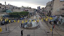
The Tulkarm Governorate (Arabic: محافظة طولكرم, romanized: Muḥāfaẓat Ṭūlkarm) is an administrative district and one of the 16 Governorates of Palestine, located in the north-western West Bank. The governorate's land area is 268 square kilometres.[2] According to the Palestinian Central Bureau of Statistics, the governorate had a population of 172,800 inhabitants.[3] The muhafaza or district capital is the city of Tulkarm.
History
During the Ottoman period, the region later forming the Tulkarm Governorate belonged to Jabal Nablus. Like other regions of Nablus' peripheral hinterland, it followed the provincial center, led by a closely knit web of economic, social and political relations between Nablus’ urban notables and the city’s surroundings. With the help of rural trading partners, these urban notables established trading monopolies that transformed Jabal Nablus’ autarkic economy into an export-driven market, shipping vast quantities of cash crops and finished goods to off-shore markets. Increasing demand for these commodities in the Ottoman Empire’s urban centers and in Europe spurred demographic growth and settlement expansion in the lowlands surrounding Jabal Nablus.[4][5]
In the 1860s, as part of the Ottoman Tanzimat, the area of Wadi al-Sha‘ir (Nahal Shechem) was incorporated into the Bani Ṣa‘b nahiya. Then, in the 1870s and 1880s, Bani Ṣa‘b was elevated into the level of a subdistrict with its qa’imaqam and municipal council administrated from Tulkarm.[4]
Localities
The Tulkarm Governorate has 51 localities and two refugee camps (Tulkarm Camp and Nur Shams Camp). The towns and cities mentioned below have populations of over 1,000.
Municipalities
Villages
| Town |
|---|
| Far'un - فرعون |
| Iktaba - إكتابا |
| 'Illar- عِلار |
| Izbat Shufa - عزبة شوفة |
| Al-Jarushiya - الجاروشية |
| Kafr Abbush - كفر عبوش |
| Kafr Jammal - كفر جمّال |
| Kafr al-Labad - كفراللبد |
| Kafr Rumman - كفر رمّان |
| Kafr Sur - كفر صور |
| Kafr Zibad - كفر زيباد |
| Khureish - خربة خريش |
| Kur - كور |
| an-Nazla al-Gharbiya - النزله الغربيه |
| an-Nazla ash-Sharqiya - النزله الشرقيه |
| an-Nazla al-Wusta - النزله الوسطه |
| Nazlat Abu Nar - نزلات ابو نار |
| Nazlat 'Isa - نزلة عيسى |
| Raml Zeita - رمل زيتة/قزازة |
| Ramin |
| Al-Ras - الرأس |
| Saffarin - سفارين |
| Seida - صيدا |
| Shufta - شوفه |
| Zeita - زيتا |
See also
References
- ^ "Main Indicators by Type of Locality - Population, Housing and Establishments Census 2017" (PDF). Palestinian Central Bureau of Statistics (PCBS). Retrieved 2021-01-19.
- ^ Tulkarm governorate Archived 2007-10-24 at the Wayback Machine
- ^ "Projected Mid -Year Population for Tulkarm Governorate by Locality 2004- 2006". Archived from the original on 2019-03-31. Retrieved 2007-11-05.
- ^ a b Marom, Roy (2024). "The Palestinian Rural Notables' Class in Ascendency: The Hannun Family of Tulkarm (Palestine)". Journal of Holy Land and Palestine Studies. 23 (1): 77–108. doi:10.3366/hlps.2024.0327. ISSN 2054-1988.
- ^ Doumani, Beshara (1995). Rediscovering Palestine: Merchants and Peasants in Jabal Nablus, 1700–1900. ISBN 978-0-520-20370-9.
Tulkarm Governorate | ||
|---|---|---|
| Cities |   | |
| Municipalities | ||
| Villages | ||
| Refugee camps | ||


Authority control databases | |
|---|---|
| International |
|
| National |
|
 | This geography of the State of Palestine article is a stub. You can help Wikipedia by expanding it. |
- v
- t
- e


