Tsamkani
Place in Paktia Province, Afghanistan
Chamkani څمکني | |
|---|---|
| 33°48′08″N 69°49′58″E / 33.8022°N 69.8329°E / 33.8022; 69.8329 | |
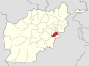
| Country |  Afghanistan Afghanistan |
| Province | Paktia Province |
| District | Chamkani District |
| Elevation | 1,788 m (5,866 ft) |
| Population | |
| • Ethnicities | Pashtuns |
| Time zone | UTC+4:30 |
Samkani (Pashto: څمکني), also spelled Chamkani or chamkani, is the main town of samkani District in Paktia Province, Afghanistan.[1]
The Chamkani tribe of the Pashtuns is settled in the area around the town.
Climate
Tsamkani has a humid continental climate (Köppen: Dfa), bordering on a monsoonal humid continental climate (Dwa) with hot summers and cold, snowy winters. Precipitation is very high most of the year.
| Climate data for Tsamkani, Paktia Province | |||||||||||||
|---|---|---|---|---|---|---|---|---|---|---|---|---|---|
| Month | Jan | Feb | Mar | Apr | May | Jun | Jul | Aug | Sep | Oct | Nov | Dec | Year |
| Mean daily maximum °C (°F) | 3.3 (37.9) | 5.0 (41.0) | 11.7 (53.1) | 17.2 (63.0) | 22.2 (72.0) | 26.1 (79.0) | 27.2 (81.0) | 25.6 (78.1) | 23.9 (75.0) | 18.3 (64.9) | 11.1 (52.0) | 6.1 (43.0) | 16.5 (61.7) |
| Daily mean °C (°F) | −0.6 (30.9) | 1.1 (34.0) | 7.0 (44.6) | 12.2 (54.0) | 17.0 (62.6) | 20.6 (69.1) | 22.0 (71.6) | 20.6 (69.1) | 18.4 (65.1) | 12.8 (55.0) | 6.7 (44.1) | 2.0 (35.6) | 11.7 (53.0) |
| Mean daily minimum °C (°F) | −4.4 (24.1) | −2.8 (27.0) | 2.2 (36.0) | 7.2 (45.0) | 11.7 (53.1) | 15.0 (59.0) | 16.7 (62.1) | 15.6 (60.1) | 12.8 (55.0) | 7.2 (45.0) | 2.2 (36.0) | −2.2 (28.0) | 6.8 (44.2) |
| Average precipitation mm (inches) | 92.5 (3.64) | 167.3 (6.59) | 191.9 (7.56) | 213.7 (8.41) | 246.0 (9.69) | 111.3 (4.38) | 163.5 (6.44) | 197.0 (7.76) | 80.3 (3.16) | 40.7 (1.60) | 54.1 (2.13) | 28.0 (1.10) | 1,586.3 (62.46) |
| Average relative humidity (%) | 51 | 58 | 57 | 50 | 42 | 35 | 49 | 56 | 48 | 39 | 42 | 39 | 47 |
| Source: World Weather Online[2] | |||||||||||||
See also
- Khost
- Loya Paktia
References
- v
- t
- e
- Aryob
- Bala Deh
- Gulakai Kot
- Khandkhel
- Mir Zakah
- Qila Niazi
- Tsamkani
- Zurmat
 | This Paktia Province, Afghanistan location article is a stub. You can help Wikipedia by expanding it. |
- v
- t
- e


