Tataskweyak Cree Nation
Split Lake 171A, Split Lake 171B
The Tataskweyak Cree Nation (Cree: ᑕᑕᐢᑿᔭᕽ, tataskwayak) (Formerly known as Split Lake Cree First Nation in English) is a First Nations band government whose primary community is located at Split Lake, Manitoba, on the Nelson River system. Despite its remote location, it is serviced by Provincial Road 280, which connects the community to Thompson.
The Split Lake band have entered into an agreement with Manitoba Hydro regarding potential hydroelectric development at Keeyask Rapids.
Its main reserve is Split Lake 171 (56°14′43″N 96°05′38″W / 56.24528°N 96.09389°W / 56.24528; -96.09389).
References
- ^ "Census Profile, 2016 Census Split Lake (Part) 171, Indian reserve [Census subdivision], Manitoba and Manitoba [Province]". Statistics Canada. Retrieved 28 August 2021.
- ^ "Census Profile, 2016 Census Split Lake (Part) 171, Indian reserve [Census subdivision], Manitoba and Manitoba [Province]". Statistics Canada. Retrieved 28 August 2021.
- ^ "AANDC (Tataskweyak Cree Nation)". Crown–Indigenous Relations and Northern Affairs Canada. Government of Canada. Retrieved 2015-02-05.
External links
- Map of Split Lake 171 (part in Census Division No. 22) at Statcan
- Map of Split Lake 171 (part in Census Division No. 23) at Statcan
- Tataskweyak Cree Nation
- v
- t
- e
First Nations in the Northern Region of Manitoba
- Barren Lands First Nation
- Berens River First Nation
- Black River First Nation
- Bloodvein First Nation
- Bunibonibee Cree Nation
- Chemawawin Cree Nation
- Cross Lake First Nation
- Fisher River Cree Nation
- Fox Lake Cree Nation
- Garden Hill First Nation
- God's Lake First Nation
- Hollow Water First Nation
- Kinonjeoshtegon First Nation
- Little Grand Rapids First Nation
- Manto Sipi Cree Nation
- Mathias Colomb First Nation
- Marcel Colomb First Nation
- Misipawistik Cree Nation
- Mosakahiken Cree Nation
- Nisichawayasihk Cree Nation
- Northlands First Nation
- Norway House Cree Nation
- O-Chi-Chak-Ko-Sipi First Nation
- Opaskwayak Cree Nation
- Pauingassi First Nation
- Peguis First Nation
- Poplar River First Nation
- Red Sucker Lake First Nation
- Sayisi Dene First Nation
- Shamattawa First Nation
- Skownan First Nation
- St. Theresa Point First Nation
- Tataskweyak Cree Nation
- War Lake First Nation
- Wasagamack First Nation
| ||
|---|---|---|
| Cities | 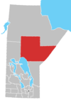 | |
| Local government districts | ||
| First Nations | ||
| Indian reserves | ||
| Indian settlements | ||
| Unorganized areas | ||
| Unincorporated communities | ||


