Stammham, Eichstätt
Municipality in Bavaria, Germany

Coat of arms
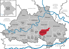
Location of Stammham within Eichstätt district
(2022-12-31)[2]
85134
Stammham is a municipality in the district of Eichstätt in Bavaria in Germany.
History
During the French invasion in Russia (1812) six men of Stammham lost their lives. 17 people died from cholera in 1873. During the First World War 26 men lost their lives. 1921 / 1922: electrification. During the Second World War 58 people lost their lives.[3]
References
- ^ Liste der ersten Bürgermeister/Oberbürgermeister in kreisangehörigen Gemeinden, Bayerisches Landesamt für Statistik, accessed 19 July 2021.
- ^ Genesis Online-Datenbank des Bayerischen Landesamtes für Statistik Tabelle 12411-003r Fortschreibung des Bevölkerungsstandes: Gemeinden, Stichtag (Einwohnerzahlen auf Grundlage des Zensus 2011) (Hilfe dazu).
- ^ "Gemeinde Stammham".
Wikimedia Commons has media related to Stammham.
- v
- t
- e
Towns and municipalities in Eichstätt (district)
- Adelschlag
- Altmannstein
- Beilngries
- Böhmfeld
- Buxheim
- Denkendorf
- Dollnstein
- Egweil
- Eichstätt
- Eitensheim
- Gaimersheim
- Großmehring
- Hepberg
- Hitzhofen
- Kinding
- Kipfenberg
- Kösching
- Lenting
- Mindelstetten
- Mörnsheim
- Nassenfels
- Oberdolling
- Pförring
- Pollenfeld
- Schernfeld
- Stammham
- Titting
- Walting
- Wellheim
- Wettstetten

Authority control databases | |
|---|---|
| International |
|
| National |
|
| This Eichstätt district location article is a stub. You can help Wikipedia by expanding it. |
- v
- t
- e


