South Valley Park
39°33′56″N 105°9′9″W / 39.56556°N 105.15250°W / 39.56556; -105.15250Area 909 acres (3.68 km2) Created 1999 Operated by Jefferson County Open Space 
Coyote Song Trail Federal State
Trails
South Valley Park is Jefferson County Open Space located in Jefferson County west of Ken Caryl, Colorado. The 909-acre (3.68 km2) Front Range park established in 1999 has 8 miles (13 km) of hiking trails. Horse and bicycle travel is allowed on 7 miles (11 km). Facilities include a parking lot, restrooms, picnic sites.[1]

The Fountain and Lyons Formations pierce the meadows and scrubland of the park. Rocky mountain juniper and Gambel oak are found around the rock spires. Commonly seen wildlife includes mule deer, elk. Common birds include steller's jay.
The park has been occupied by humans as early as 10,000 years ago. The earliest evidence is a 10,000-year-old Folsom spear point found in the park. Numerous fire pits and stone tools have also been found in the area. A human skull found at a burial site has been carbon dated to approximately 1,900 years ago.[2]
Gallery
-
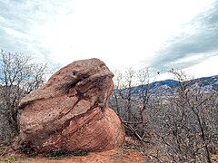 red rock formation
 -
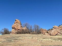
 red rock formations
 -
 rock with lichen
 -
 Columbine trail
 -
 Cathy Johnson trail marker
 -
 Columbine trail marker
 -
 trail
trail -
 steps on trail
 -
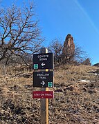 Coyote Song and Swallow Trail marker sign
 -
 red rocks
 -
 tall red rocks


References
https://www.jeffco.us/1431/South-Valley-Park
External links
- "South Valley Park". Jefferson County, CO.
- v
- t
- e

| 43 State Parks |
|
|---|---|
| 1 State Forest | |
| 307 State Wildlife Areas | |
| 96 State Natural Areas |
|
| 26 Scenic and Historic Byways |
|
| 28 National Recreation Trails |
|
|---|---|
| 6 Regional Trails |
 | This Colorado state location article is a stub. You can help Wikipedia by expanding it. |
- v
- t
- e
This article related to a protected area in Colorado is a stub. You can help Wikipedia by expanding it. |
- v
- t
- e


