Setiu District
District of Malaysia in Terengganu

Flag

Seal
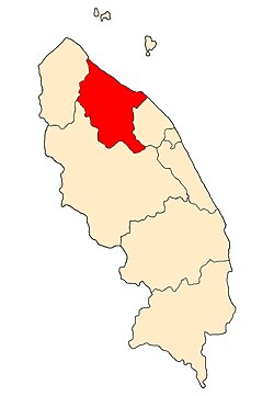
Location of Setiu District in Terengganu
 Malaysia
 Terengganu
 (2010)[3]
(2014)[4]
22xxx
Setiu is one of the districts in Terengganu, Malaysia. This district is bordered by Besut to the north, Hulu Terengganu to the south, and on the east, Kuala Nerus District.
Setiu is the second youngest and least populated district in Terengganu. Its capital is Bandar Permaisuri which also serves as its economic and commercial centre. Other towns are Chalok, Sungai Tong, Guntong and Penarik.
Etymology and history
The district of Setiu is believed to have taken its name from a Tok Setiu, a Bugis commander who escaped the Dutch conquest of the Indonesian archipelago in the 19th century and immigrated to Terengganu. The Sultan allowed Tok Setiu and his followers to open a kampong in the plains located north of Kuala Terengganu.
Setiu, as a district, had existed as early as the 1920s, with a smaller territory than its present-day borders, during the early days of British protection over Terengganu. In 1923 it was annexed into the neighbouring Besut District until 1935, when it was made a separate district. That same year Setiu district was partitioned between Besut district and the state capital Kuala Terengganu. Setiu district with its present-day borders was reorganised in 1985, merging Mukim Merang, Mukim Hulu Nerus and Mukim Belara (portion) from Kuala Terengganu (now Kuala Nerus) and Mukim Caluk, Mukim Guntung, Mukim Pantai Tasik and Mukim Hulu Setiu from Besut.[5][6]
Demographics
| Year | Pop. | ±% | |
|---|---|---|---|
| 1991 | 42,434 | — | |
| 2000 | 50,346 | +18.6% | |
| 2010 | 54,563 | +8.4% | |
| 2020 | 59,651 | +9.3% | |
| |||
| Source: [7] | |||
Majority of the inhabitants of Setiu are ethnic Malays, with remainder from the minority Chinese, Siamese and Indian communities. Most Malays in Setiu especially in the northern part speaks Kelantan-Pattani Malay however those that live in southern Setiu speaks Terengganu Malay.
Administrative divisions

Setiu is divided into 7 mukims, which are:[2]
- Chaluk
- Guntung
- Hulu Nerus
- Hulu Setiu
- Merang
- Pantai
- Tasik
Tourist attractions
Among the places of interest in this district are Terengganu International Equestrian Park (TIEP), Setiu Wetlands, Lata Payung, Lata Changkah, Mount Tebu, Rhu Sepuluh Beach, and Terrapuri CUltural Village.
Federal Parliament and State Assembly Seats
List of LMS district representatives in the Federal Parliament (Dewan Rakyat)
| Parliament | Seat Name | Member of Parliament | Party |
|---|---|---|---|
| P34 | Setiu | Shaharizukirnain Abdul Kadir | Perikatan Nasional (PAS) |
List of LMS district representatives in the State Legislative Assembly of Terengganu
| Parliament | State | Seat Name | State Assemblyman | Party |
|---|---|---|---|---|
| P34 | N6 | Permaisuri | Mohd Yusof Majid | Perikatan Nasional (BERSATU) |
| P34 | N7 | Langkap | Azmi Maarof | Perikatan Nasional (PAS) |
See also
Wikimedia Commons has media related to Setiu.
References
- ^ Administrator. "Laman Web Rasmi Pejabat Daerah Dan Tanah Dungun". pdtsetiu.terengganu.gov.my.
- ^ a b Administrator. "LATARBELAKANG DAERAH SETIU". pdtsetiu.terengganu.gov.my.
- ^ "Population Distribution and Basic Demographic Characteristics, 2010" (PDF). Department of Statistics, Malaysia. Archived from the original (PDF) on 22 May 2014. Retrieved 19 April 2012.
- ^ Administrator. "Pengenalan Daerah Dungun". pdtdungun.terengganu.gov.my.
- ^ "LATARBELAKANG DAERAH SETIU". Laman Web Rasmi Pejabat Daerah dan Tanah Setiu. Retrieved 3 December 2019.
- ^ "Daerah di Terengganu". Ganupedia. Retrieved 3 December 2019.
- ^ "Key Findings of Population and Housing Census of Malaysia 2020" (pdf) (in Malay and English). Department of Statistics, Malaysia. ISBN 978-967-2000-85-3.
- v
- t
- e
State of Terengganu
Capital: Kuala Terengganu
- Index
- History
- Constitution
- Elections
- Government
- Geography
- Judiciary
- Law
- Music
- Terengganuans
- Symbols
- Tourist attractions
- Culture
- Crime
- Cuisine
- Demographics
- Economy
- Education
- Politics
- Language
divisions
 Commons
 Wikisource
 Category

Authority control databases | |
|---|---|
| International |
|
| National |
|


