Samaran, Gers
Commune in Occitania, France
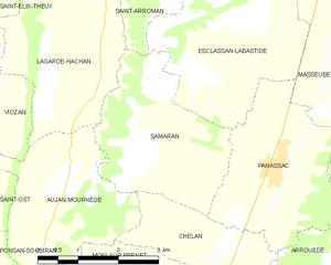
Location of Samaran

(2020–2026) Éric Thore[1]
1
(2021)[2]
32409 /32140
Samaran (French pronunciation: [samaʁɑ̃]) is a commune in the Gers department in southwestern France.
Geography
Population
| Year | Pop. | ±% |
|---|---|---|
| 1962 | 146 | — |
| 1968 | 136 | −6.8% |
| 1975 | 129 | −5.1% |
| 1982 | 112 | −13.2% |
| 1990 | 95 | −15.2% |
| 1999 | 94 | −1.1% |
| 2008 | 93 | −1.1% |
See also
References
- ^ "Répertoire national des élus: les maires" (in French). data.gouv.fr, Plateforme ouverte des données publiques françaises. 13 September 2022.
- ^ "Populations légales 2021". The National Institute of Statistics and Economic Studies. 28 December 2023.
Wikimedia Commons has media related to Samaran (Gers).
- v
- t
- e
Communes of the Gers department 

- Aignan
- Ansan
- Antras
- Arblade-le-Bas
- Arblade-le-Haut
- Ardizas
- Armentieux
- Armous-et-Cau
- Arrouède
- Aubiet
- Auchpref
- Augnax
- Aujan-Mournède
- Auradé
- Aurensan
- Aurimont
- Aussos
- Auterive
- Aux-Aussat
- Avensac
- Avéron-Bergelle
- Avezan
- Ayguetinte
- Ayzieu
- Bajonnette
- Barcelonne-du-Gers
- Barcugnan
- Barran
- Bars
- Bascous
- Bassoues
- Bazian
- Bazugues
- Beaucaire
- Beaumarchés
- Beaumont
- Beaupuy
- Beccas
- Bédéchan
- Bellegarde
- Belloc-Saint-Clamens
- Belmont
- Béraut
- Berdoues
- Bernède
- Berrac
- Betcave-Aguin
- Bétous
- Betplan
- Bézéril
- Bezolles
- Bézues-Bajon
- Biran
- Bivès
- Blanquefort
- Blaziert
- Blousson-Sérian
- Bonas
- Boucagnères
- Boulaur
- Bourrouillan
- Bouzon-Gellenave
- Bretagne-d'Armagnac
- Le Brouilh-Monbert
- Brugnens
- Cabas-Loumassès
- Cadeilhan
- Cadeillan
- Cahuzac-sur-Adour
- Caillavet
- Callian
- Campagne-d'Armagnac
- Cassaigne
- Castelnau-Barbarens
- Castelnau-d'Anglès
- Castelnau-d'Arbieu
- Castelnau-d'Auzan-Labarrère
- Castelnau-sur-l'Auvignon
- Castelnavet
- Castéra-Lectourois
- Castéra-Verduzan
- Castéron
- Castet-Arrouy
- Castex
- Castex-d'Armagnac
- Castillon-Debats
- Castillon-Massas
- Castillon-Savès
- Castin
- Catonvielle
- Caumont
- Caupenne-d'Armagnac
- Caussens
- Cazaubon
- Cazaux-d'Anglès
- Cazaux-Savès
- Cazaux-Villecomtal
- Cazeneuve
- Céran
- Cézan
- Chélan
- Clermont-Pouyguillès
- Clermont-Savès
- Cologne
- Condomsubpr
- Corneillan
- Couloumé-Mondebat
- Courrensan
- Courties
- Crastes
- Cravencères
- Cuélas
- Dému
- Duffort
- Duran
- Durban
- Eauze
- Encausse
- Endoufielle
- Esclassan-Labastide
- Escornebœuf
- Espaon
- Espas
- Estampes
- Estang
- Estipouy
- Estramiac
- Faget-Abbatial
- Flamarens
- Fleurance
- Fourcès
- Frégouville
- Fustérouau
- Galiax
- Garravet
- Gaudonville
- Gaujac
- Gaujan
- Gavarret-sur-Aulouste
- Gazaupouy
- Gazax-et-Baccarisse
- Gée-Rivière
- Gimbrède
- Gimont
- Giscaro
- Gondrin
- Goutz
- Goux
- Haget
- Haulies
- Homps
- Le Houga
- Idrac-Respaillès
- L'Isle-Arné
- L'Isle-Bouzon
- L'Isle-de-Noé
- L'Isle-Jourdain
- Izotges
- Jegun
- Jû-Belloc
- Juillac
- Juilles
- Justian
- Laas
- Labarthe
- Labarthète
- Labastide-Savès
- Labéjan
- Labrihe
- Ladevèze-Rivière
- Ladevèze-Ville
- Lagarde
- Lagarde-Hachan
- Lagardère
- Lagraulet-du-Gers
- Laguian-Mazous
- Lahas
- Lahitte
- Lalanne
- Lalanne-Arqué
- Lamaguère
- Lamazère
- Lamothe-Goas
- Lannemaignan
- Lannepax
- Lanne-Soubiran
- Lannux
- Larée
- Larressingle
- Larroque-Engalin
- Larroque-Saint-Sernin
- Larroque-sur-l'Osse
- Lartigue
- Lasséran
- Lasserrade
- Lasseube-Propre
- Laujuzan
- Lauraët
- Lavardens
- Laveraët
- Laymont
- Leboulin
- Lectoure
- Lelin-Lapujolle
- Lias
- Lias-d'Armagnac
- Ligardes
- Lombez
- Loubédat
- Loubersan
- Lourties-Monbrun
- Louslitges
- Loussous-Débat
- Lupiac
- Luppé-Violles
- Lussan
- Magnan
- Magnas
- Maignaut-Tauzia
- Malabat
- Manas-Bastanous
- Manciet
- Manent-Montané
- Mansempuy
- Mansencôme
- Marambat
- Maravat
- Marciac
- Marestaing
- Margouët-Meymes
- Marguestau
- Marsan
- Marseillan
- Marsolan
- Mascaras
- Mas-d'Auvignon
- Masseube
- Mauléon-d'Armagnac
- Maulichères
- Maumusson-Laguian
- Maupas
- Maurens
- Mauroux
- Mauvezin
- Meilhan
- Mérens
- Miélan
- Miradoux
- Miramont-d'Astarac
- Miramont-Latour
- Mirandesubpr
- Mirannes
- Mirepoix
- Monbardon
- Monblanc
- Monbrun
- Moncassin
- Monclar
- Monclar-sur-Losse
- Moncorneil-Grazan
- Monferran-Plavès
- Monferran-Savès
- Monfort
- Mongausy
- Monguilhem
- Monlaur-Bernet
- Monlezun
- Monlezun-d'Armagnac
- Monpardiac
- Montadet
- Montamat
- Montaut
- Montaut-les-Créneaux
- Mont-d'Astarac
- Mont-de-Marrast
- Montégut
- Montégut-Arros
- Montégut-Savès
- Montesquiou
- Montestruc-sur-Gers
- Monties
- Montiron
- Montpézat
- Montréal
- Mormès
- Mouchan
- Mouchès
- Mourède
- Nizas
- Nogaro
- Noilhan
- Nougaroulet
- Noulens
- Orbessan
- Ordan-Larroque
- Ornézan
- Pallanne
- Panassac
- Panjas
- Pauilhac
- Pavie
- Pébées
- Pellefigue
- Perchède
- Pergain-Taillac
- Pessan
- Pessoulens
- Peyrecave
- Peyrusse-Grande
- Peyrusse-Massas
- Peyrusse-Vieille
- Pis
- Plaisance
- Plieux
- Polastron
- Pompiac
- Ponsampère
- Ponsan-Soubiran
- Pouydraguin
- Pouylebon
- Pouy-Loubrin
- Pouy-Roquelaure
- Préchac
- Préchac-sur-Adour
- Preignan
- Préneron
- Projan
- Pujaudran
- Puycasquier
- Puylausic
- Puységur
- Ramouzens
- Razengues
- Réans
- Réjaumont
- Ricourt
- Riguepeu
- Riscle
- La Romieu
- Roquebrune
- Roquefort
- Roquelaure
- Roquelaure-Saint-Aubin
- Roquepine
- Roques
- Rozès
- Sabaillan
- Sabazan
- Sadeillan
- Saint-André
- Saint-Antoine
- Saint-Antonin
- Saint-Arailles
- Saint-Arroman
- Saint-Aunix-Lengros
- Saint-Avit-Frandat
- Saint-Blancard
- Saint-Brès
- Saint-Caprais
- Saint-Christaud
- Saint-Clar
- Saint-Créac
- Saint-Cricq
- Sainte-Anne
- Sainte-Aurence-Cazaux
- Sainte-Christie
- Sainte-Christie-d'Armagnac
- Sainte-Dode
- Sainte-Gemme
- Saint-Élix-d'Astarac
- Saint-Élix-Theux
- Sainte-Marie
- Sainte-Mère
- Sainte-Radegonde
- Saint-Georges
- Saint-Germé
- Saint-Germier
- Saint-Griède
- Saint-Jean-le-Comtal
- Saint-Jean-Poutge
- Saint-Justin
- Saint-Lary
- Saint-Léonard
- Saint-Lizier-du-Planté
- Saint-Loube
- Saint-Martin
- Saint-Martin-d'Armagnac
- Saint-Martin-de-Goyne
- Saint-Martin-Gimois
- Saint-Maur
- Saint-Médard
- Saint-Mézard
- Saint-Michel
- Saint-Mont
- Saint-Orens
- Saint-Orens-Pouy-Petit
- Saint-Ost
- Saint-Paul-de-Baïse
- Saint-Pierre-d'Aubézies
- Saint-Puy
- Saint-Sauvy
- Saint-Soulan
- Salles-d'Armagnac
- Samaran
- Samatan
- Sansan
- Saramon
- Sarcos
- Sarragachies
- Sarraguzan
- Sarrant
- La Sauvetat
- Sauveterre
- Sauviac
- Sauvimont
- Savignac-Mona
- Scieurac-et-Flourès
- Séailles
- Ségos
- Ségoufielle
- Seissan
- Sembouès
- Sémézies-Cachan
- Sempesserre
- Sère
- Sérempuy
- Seysses-Savès
- Simorre
- Sion
- Sirac
- Solomiac
- Sorbets
- Tachoires
- Tarsac
- Tasque
- Taybosc
- Termes-d'Armagnac
- Terraube
- Thoux
- Tieste-Uragnoux
- Tillac
- Tirent-Pontéjac
- Touget
- Toujouse
- Tourdun
- Tournan
- Tournecoupe
- Tourrenquets
- Traversères
- Troncens
- Tudelle
- Urdens
- Urgosse
- Valence-sur-Baïse
- Vergoignan
- Verlus
- Vic-Fezensac
- Viella
- Villecomtal-sur-Arros
- Villefranche-d'Astarac
- Viozan
- pref: prefecture
- subpr: subprefecture
| Authority control databases: National |
|
|---|
 | This Gers geographical article is a stub. You can help Wikipedia by expanding it. |
- v
- t
- e


