Saint-André-de-Kamouraska
Municipality in Quebec, Canada
47°41′N 69°44′W / 47.683°N 69.733°W / 47.683; -69.733[1] Canada
 Quebec
contradiction between two
authoritative sources
(2011)[3]
 5.3%
5.3%
 R-132
R-132  R-230
R-230  R-289
R-289dekamouraska.ca
Saint-André-de-Kamouraska is a municipality in the Canadian province of Quebec, located in the Kamouraska Regional County Municipality. Before 2020 it was only known as Saint-André.
Geography
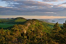
Saint-André-de-Kamouraska is located on the southern shoreline of the Saint Lawrence River along with several islands belonging to the municipality situated offshore to the north.
Communities
The following locations reside within the municipality's boundaries:[1]
- Saint-André (47°40′33″N 69°43′29″W / 47.67583°N 69.72472°W / 47.67583; -69.72472 (Saint-André, Saint-André, QC))
- Saint-André-Station (47°37′49″N 69°41′09″W / 47.63028°N 69.68583°W / 47.63028; -69.68583 (Saint-André-Station, Saint-André, QC)) – a hamlet in the southeast part of the municipality
Lakes and rivers
The following waterways pass through or are situated within the municipality's boundaries:[1]
- Rivière des Caps (Mouth:47°43′21″N 69°40′35″W / 47.72250°N 69.67639°W / 47.72250; -69.67639 (Rivière des Caps, Saint-André, QC))
- Rivière Fouquette (Mouth:47°42′04″N 69°42′09″W / 47.70111°N 69.70250°W / 47.70111; -69.70250 (Rivière Fouquette, Saint-André, QC))
Municipal council
- Mayor: Gervais Darisse
See also
- Saguenay–St. Lawrence Marine Park
- Île aux Lièvres (Saint Lawrence River)
- List of municipalities in Quebec
References
- ^ a b c "Banque de noms de lieux du Québec: Reference number 55585". toponymie.gouv.qc.ca (in French). Commission de toponymie du Québec.
- ^ a b "Répertoire des municipalités: Geographic code 14040". www.mamh.gouv.qc.ca (in French). Ministère des Affaires municipales et de l'Habitation.
- ^ a b "Saint-André-de-Kamouraska (Code 2414040) Census Profile". 2011 census. Government of Canada - Statistics Canada.
External links
 Media related to Saint-André-de-Kamouraska at Wikimedia Commons
Adjacent Municipal Subdivisions | |
|---|---|


- v
- t
- e
 Subdivisions of Kamouraska Regional County Municipality
- Regional County Municipalities in Bas-Saint-Laurent:
Kamouraska - La Matapédia
- La Mitis
- Les Basques
- La Matanie
- Rimouski-Neigette
- Rivière-du-Loup
- Témiscouata
- Indian Reserves
- Cacouna
- Kataskomiq
Authority control databases | |
|---|---|
| International |
|
| National |
|


