Sénas
Commune in Provence-Alpes-Côte d'Azur, France
You can help expand this article with text translated from the corresponding article in French. (December 2008) Click [show] for important translation instructions.
- View a machine-translated version of the French article.
- Machine translation, like DeepL or Google Translate, is a useful starting point for translations, but translators must revise errors as necessary and confirm that the translation is accurate, rather than simply copy-pasting machine-translated text into the English Wikipedia.
- Do not translate text that appears unreliable or low-quality. If possible, verify the text with references provided in the foreign-language article.
- You must provide copyright attribution in the edit summary accompanying your translation by providing an interlanguage link to the source of your translation. A model attribution edit summary is
Content in this edit is translated from the existing French Wikipedia article at [[:fr:Sénas]]; see its history for attribution. - You may also add the template
{{Translated|fr|Sénas}}to the talk page. - For more guidance, see Wikipedia:Translation.
Commune in Provence-Alpes-Côte d'Azur, France
Sénas Senàs (Occitan) | ||
|---|---|---|
Commune | ||
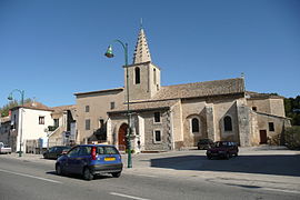 The church in Sénas | ||
 Coat of arms | ||
Location of Sénas  | ||
(2020–2026) Philippe Ginoux[1] | | |
| Area 1 | 30.61 km2 (11.82 sq mi) | |
| Population (2021)[2] | 6,838 | |
| • Density | 220/km2 (580/sq mi) | |
| Time zone | UTC+01:00 (CET) | |
| • Summer (DST) | UTC+02:00 (CEST) | |
| INSEE/Postal code | 13105 /13560 | |
| Elevation | 85–273 m (279–896 ft) (avg. 95 m or 312 ft) | |
| 1 French Land Register data, which excludes lakes, ponds, glaciers > 1 km2 (0.386 sq mi or 247 acres) and river estuaries. | ||
Sénas (French pronunciation: [senas]; Occitan: Senàs) is a commune in the Bouches-du-Rhône department in the Provence-Alpes-Côte d'Azur region in Southern France. Sénas is located on the departmental border with Vaucluse, which follows the river Durance.
Demographics
|
| ||||||||||||||||||||||||||||||||||||||||||||||||||||||||||||||||||||||||||||||||||||||||||||||||||||||||||||||||||
| Source: EHESS[3] and INSEE (1968–2020)[4] | |||||||||||||||||||||||||||||||||||||||||||||||||||||||||||||||||||||||||||||||||||||||||||||||||||||||||||||||||||
See also
References
- ^ "Répertoire national des élus: les maires". data.gouv.fr, Plateforme ouverte des données publiques françaises (in French). 2 December 2020.
- ^ "Populations légales 2021". The National Institute of Statistics and Economic Studies. 28 December 2023.
- ^ Des villages de Cassini aux communes d'aujourd'hui: Commune data sheet Sénas, EHESS (in French).
- ^ Population en historique depuis 1968, INSEE
Wikimedia Commons has media related to Senas.
- v
- t
- e

- Aix-en-Provencesubpr
- Allauch
- Alleins
- Arlessubpr
- Aubagne
- Aureille
- Auriol
- Aurons
- La Barben
- Barbentane
- Les Baux-de-Provence
- Beaurecueil
- Belcodène
- Berre-l'Étang
- Bouc-Bel-Air
- La Bouilladisse
- Boulbon
- Cabannes
- Cabriès
- Cadolive
- Carnoux-en-Provence
- Carry-le-Rouet
- Cassis
- Ceyreste
- Charleval
- Châteauneuf-le-Rouge
- Châteauneuf-les-Martigues
- Châteaurenard
- La Ciotat
- Cornillon-Confoux
- Coudoux
- Cuges-les-Pins
- La Destrousse
- Éguilles
- Ensuès-la-Redonne
- Eygalières
- Eyguières
- Eyragues
- La Fare-les-Oliviers
- Fontvieille
- Fos-sur-Mer
- Fuveau
- Gardanne
- Gémenos
- Gignac-la-Nerthe
- Grans
- Graveson
- Gréasque
- Istressubpr
- Jouques
- Lamanon
- Lambesc
- Lançon-Provence
- Maillane
- Mallemort
- Marignane
- Marseillepref
- Martigues
- Mas-Blanc-des-Alpilles
- Maussane-les-Alpilles
- Meyrargues
- Meyreuil
- Mimet
- Miramas
- Mollégès
- Mouriès
- Noves
- Orgon
- Paradou
- Pélissanne
- Les Pennes-Mirabeau
- La Penne-sur-Huveaune
- Peynier
- Peypin
- Peyrolles-en-Provence
- Plan-de-Cuques
- Plan-d'Orgon
- Port-de-Bouc
- Port-Saint-Louis-du-Rhône
- Puyloubier
- Le Puy-Sainte-Réparade
- Rognac
- Rognes
- Rognonas
- La Roque-d'Anthéron
- Roquefort-la-Bédoule
- Roquevaire
- Rousset
- Le Rove
- Saint-Andiol
- Saint-Antonin-sur-Bayon
- Saint-Cannat
- Saint-Chamas
- Saintes-Maries-de-la-Mer
- Saint-Estève-Janson
- Saint-Étienne-du-Grès
- Saint-Marc-Jaumegarde
- Saint-Martin-de-Crau
- Saint-Mitre-les-Remparts
- Saint-Paul-lès-Durance
- Saint-Pierre-de-Mézoargues
- Saint-Rémy-de-Provence
- Saint-Savournin
- Saint-Victoret
- Salon-de-Provence
- Sausset-les-Pins
- Sénas
- Septèmes-les-Vallons
- Simiane-Collongue
- Tarascon
- Le Tholonet
- Trets
- Vauvenargues
- Velaux
- Venelles
- Ventabren
- Vernègues
- Verquières
- Vitrolles
- pref: prefecture
- subpr: subprefecture
Authority control databases | |
|---|---|
| International |
|
| National |
|
 | This Bouches-du-Rhône geographical article is a stub. You can help Wikipedia by expanding it. |
- v
- t
- e


