Rhenoy
Village in Gelderland, Netherlands
51°53′04″N 5°09′16″E / 51.88445°N 5.15442°E / 51.88445; 5.15442 (2021)[1]
4152[1]
Rhenoy is a village in the Dutch province of Gelderland. It is a part of the municipality of West Betuwe, and is situated about 13 km east of Gorinchem, between Geldermalsen and Leerdam.
History
It was first mentioned in 1265 as tot Rynoey, and means "land neat a stream". It is not related to the Rhine, also because it is located on the Linge.[3] The Dutch Reformed church dates from 1836, but has 14th and 15th century elements. In 1840, it was home to 319 people.[4]
Gallery
-
 Street in Rhenoy
 -
 House in Rhenoy
 -
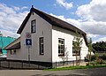 Cornerhouse
 -
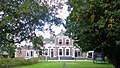 Villa in Rhenoy


References
- ^ a b c "Kerncijfers wijken en buurten 2021". Central Bureau of Statistics. Retrieved 24 March 2022.
two entries
- ^ "Postcodetool for 4152EA". Actueel Hoogtebestand Nederland (in Dutch). Het Waterschapshuis. Retrieved 24 March 2022.
- ^ "Rhenoy - (geografische naam)". Etymologiebank (in Dutch). Retrieved 24 March 2022.
- ^ "Rhenoy". Plaatsengids (in Dutch). Retrieved 24 March 2022.
 | This Gelderland location article is a stub. You can help Wikipedia by expanding it. |
- v
- t
- e


