Querqueville
Part of Cherbourg-en-Cotentin in Normandy, France

Coat of arms
Location of Querqueville

49°39′51″N 1°41′38″W / 49.6642°N 1.6939°W / 49.6642; -1.6939
1
(2019)[1]
50460
(avg. 50 m or 160 ft)

Querqueville (French pronunciation: [kɛʁkəvil]) is a former commune in the Manche department in north-western France. On 1 January 2016, it was merged into the new commune of Cherbourg-en-Cotentin.[2]
The Chapel of Saint Germanus (Chapelle Saint-Germain) with its trefoil floorplan incorporates elements of one of the earliest surviving places of Christian worship in the Cotentin Peninsula - perhaps second only to the Gallo-Roman baptistry at Port-Bail.
Heraldry
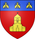 | The arms of Querqueville are blazoned: Gules, a trefoil chapel Or, pierced and open sable, on a chief azure, three bees Or.
|
History
During WII, Querqueville Airfield (Advanced Landing Ground) was rebuilt on a former French Navy airfield.
See also
References
Wikimedia Commons has media related to Querqueville.
Authority control databases | |
|---|---|
| International |
|
| National |
|
| Geographic |
|
- v
- t
- e


