Qikiqtaryuaq
Island in Nunavut, Canada
68°43′17″N 102°02′12″W / 68.72139°N 102.03667°W / 68.72139; -102.03667[1]
Canada
Qikiqtaryuaq, formerly Jenny Lind Island,[2] for the Swedish born opera singer, Jenny Lind, is a small island 420 km2 (160 sq mi) in the Kitikmeot Region of Nunavut, Canada. The island is located in the Queen Maud Gulf, about 120 km (75 mi) southeast of Cambridge Bay.
The island is the site of CAM-1A (Jenny Lind Island), a former Distant Early Warning Line site and home to the unmanned North Warning System site.
Geography

Characteristics of the terrain include rocky ridges, low-lying wetlands, sedge meadows, and a sandy shoreline.
Fauna
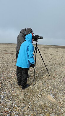
Qikiqtaryuaq is a Canadian Important Bird Area (#NU088), and a Key Migratory Terrestrial Bird Site. Notable bird species include Canada goose, lesser snow goose, and Ross's goose.[3]
Muskoxen are found in the south east section of the island.
Climate
| Climate data for Jenny Lind Island Airport (1961-1990) | |||||||||||||
|---|---|---|---|---|---|---|---|---|---|---|---|---|---|
| Month | Jan | Feb | Mar | Apr | May | Jun | Jul | Aug | Sep | Oct | Nov | Dec | Year |
| Record high °C (°F) | −5.1 (22.8) | −8.8 (16.2) | −7.8 (18.0) | 2.8 (37.0) | 6.1 (43.0) | 18.3 (64.9) | 22.8 (73.0) | 20.6 (69.1) | 15.0 (59.0) | 6.0 (42.8) | 0.6 (33.1) | −2.8 (27.0) | 22.8 (73.0) |
| Mean daily maximum °C (°F) | — | — | −26.1 (−15.0) | −17.3 (0.9) | −5.8 (21.6) | 3.2 (37.8) | 9.6 (49.3) | 7.2 (45.0) | 1.0 (33.8) | −7.5 (18.5) | −19.2 (−2.6) | −25.1 (−13.2) | — |
| Daily mean °C (°F) | — | — | −29.9 (−21.8) | −21.6 (−6.9) | −9.3 (15.3) | 0.7 (33.3) | 6.1 (43.0) | 4.5 (40.1) | −0.9 (30.4) | −10.4 (13.3) | −22.7 (−8.9) | −28.6 (−19.5) | — |
| Mean daily minimum °C (°F) | −37.2 (−35.0) | −37.4 (−35.3) | −34.6 (−30.3) | −26.1 (−15.0) | −13.0 (8.6) | −1.9 (28.6) | 2.6 (36.7) | 1.7 (35.1) | −3.0 (26.6) | −13.6 (7.5) | −26.7 (−16.1) | −33.2 (−27.8) | −18.5 (−1.3) |
| Record low °C (°F) | −51.2 (−60.2) | −51.2 (−60.2) | −50.0 (−58.0) | −43.3 (−45.9) | −30.6 (−23.1) | −17.2 (1.0) | −2.8 (27.0) | −7.8 (18.0) | −16.7 (1.9) | −33.2 (−27.8) | −42.8 (−45.0) | −47.2 (−53.0) | −51.2 (−60.2) |
| Average precipitation mm (inches) | 2.2 (0.09) | 2.4 (0.09) | 2.7 (0.11) | 3.9 (0.15) | 5.9 (0.23) | 10.6 (0.42) | 19.6 (0.77) | 25.9 (1.02) | 18.6 (0.73) | 14.0 (0.55) | 5.5 (0.22) | 3.0 (0.12) | 114.3 (4.50) |
| Source: 1961-1990 Environment and Climate Change Canada[4] | |||||||||||||
History
The island is uninhabited but still has an active North Warning System. Originally part of the Distant Early Warning Line, the site is known as CAM-1.
References
Wikimedia Commons has media related to Jenny Lind Island.
- ^ "Qikiqtaryuaq". Geographical Names Data Base. Natural Resources Canada.
- ^ "Jenny Lind Island". Geographical Names Data Base. Natural Resources Canada.
- ^ "Jenny Lind Island". Important Bird and Biodiversity Areas in Canada. Retrieved 2014-01-05.
- ^ Environment and Climate Change Canada—Canadian Climate Normals 1961–1990. Retrieved 22 June 2011.
- The Atlas of Canada - Sea Islands
- Kitikmeot Regional Land Use Plan
- CAM-1 plan
- v
- t
- e
Islands of the Kitikmeot Region
- Beverly
- Bryde
- Clarence
- De la Roquette
- Dixon
- Finlayson
- Gibson
- Hay
- Hobday
- Hovgaard
- Keith
- King William
- Little Camping
- Matty
- Minto
- Montreal
- O'Reilly
- Prince of Wales
- Putulik
- Qikiqtagafaaluk
- Qikiqtaryuaq
- Qikiqtaryuaq (Queen Maud Gulf)
- Royal Geographical Society
- Stefansson
- Sutton
- Tasmania
- Tennent
- Umingmalik
- Victoria
- Winter
- Algaq
- Aupilaktuq
- Barry
- Chapman
- Galena
- Iqalulialuk
- Igluhugyuk
- Marcet
- North Quadyuk
- Patsy Klengenberg
- Qannuyak
- Qannuyak (Barry Islands)
- Qikiqtaryuaq (Bathurst Inlet)
- Quadyuk
- Shoe
- Stockport
- Triple
- Walrus
- Wignick
- Aiyohok
- Akvitlak
- Anchor
- Bate
- Berens
- Black Berry
- Blaze
- Cockburn
- Couper
- Deadman
- Doak
- Duke of York
- Edinburgh
- Haodlon
- Hatoayok
- Hepburn
- Hokagon
- Home
- Ivuniryuaq
- Jameson
- Kabviukvik
- Kigirktaryuk
- Kitaagunnaat
- Kingak
- Lawford
- Leo
- Mangak
- Miles
- Nakahungaqtuaryuit
- Nallukatarvik
- Nanortut
- Nanukton
- Nattiqtuut
- Nauyan
- Nichols
- Onitkok
- Outcast
- Porden
- Richardson
- Sesqui
- Seven Mile
- Sir Graham Moore
- Sisters
- Takhoalok
- Ungiiviit
- Astronomical Society
- Copeland
- Harrison
- Hecla and Fury
- Helen
- Lady Parry
- Martin
- Pouncet
- Somerset
- Susanna
- Wales
Islands in italics are inhabited. See also Canadian Arctic Archipelago, Islands of the Kivalliq Region, Islands of the Qikiqtaaluk Region
This bird-related article is a stub. You can help Wikipedia by expanding it. |
- v
- t
- e
 | This Kitikmeot Region, Nunavut location article is a stub. You can help Wikipedia by expanding it. |
- v
- t
- e


