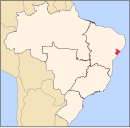
Pirambu
Municipality in Sergipe, Brazil

Flag

Seal
(2020 [1])
Pirambu is a municipality located in the Brazilian state of Sergipe. Its population was 9,359 (2020) and its area is 218 km2.[2]
The municipality contains part of the 5,547 hectares (13,710 acres) Santa Isabel Biological Reserve, a strictly protected conservation unit created in 1988.[3]
References
- ^ "IBGE 2020". Retrieved 26 January 2021.
- ^ IBGE - "Archived copy". Archived from the original on January 9, 2007. Retrieved August 3, 2014.
{{cite web}}: CS1 maint: archived copy as title (link) - ^ Unidade de Conservação: Reserva Biológica de Santa Isabel (in Portuguese), MMA: Ministério do Meio Ambiente, retrieved 2016-04-17
- v
- t
- e
Capital: Aracaju
| Agreste de Itabaiana |
|
|---|---|
| Agreste de Lagarto |
|
| Nossa Senhora das Dores | |
| Tobias Barreto |

| Aracaju | |
|---|---|
| Baixo Cotinguiba | |
| Boquim | |
| Cotinguiba | |
| Estancia | |
| Japaratuba |
|
| Propria |
| Carira | |
|---|---|
| Sergipana do Sertao do Sao Francisco |
 | This Sergipe, Brazil location article is a stub. You can help Wikipedia by expanding it. |
- v
- t
- e


