Pfunds
Place in Tyrol, Austria

Coat of arms
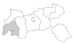
Location within Tyrol
(2018-01-01)[2]
6542
Pfunds is a municipality in the district of Landeck in the Austrian state of Tyrol located 19.7 km south of the city of Landeck and 5 km north of the border to Switzerland. The village was first mentioned in documents in 1282. The main source of income is tourism.

Geography
Populated places
The municipality of Kirchdorf consists of the following populated places; the first two are villages while the rest are hamlets.[3]
- Pfunds-Stuben
- Pfunds-Dorf
- Airsch
- Birkach
- Greit
- Hinterkobel
- Kobl
- Lafairs
- Margreid
- Mariastein
- Rauth
- Schönegg
- Stein
- Vorderkobel
- Wand
References
- ^ "Dauersiedlungsraum der Gemeinden Politischen Bezirke und Bundesländer - Gebietsstand 1.1.2018". Statistics Austria. Retrieved 10 March 2019.
- ^ "Einwohnerzahl 1.1.2018 nach Gemeinden mit Status, Gebietsstand 1.1.2018". Statistics Austria. Retrieved 9 March 2019.
- ^ Pfunds - Gemeinde - Startseite - Gemeindeamt - Web - Suche
Wikimedia Commons has media related to Pfunds.
- v
- t
- e
Municipalities in the district of Landeck
Authority control databases | |
|---|---|
| International |
|
| National |
|
| Other |
|
 | This Tyrol location article is a stub. You can help Wikipedia by expanding it. |
- v
- t
- e


