Palestine Township, Woodford County, Illinois
Township in Illinois, United States
Palestine Township | |
|---|---|
Township | |
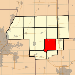 Location in Woodford County | |
| Country | United States |
| State | Illinois |
| County | Woodford |
| Established | November 7, 1854 |
| Area | |
| • Total | 37.54 sq mi (97.2 km2) |
| • Land | 37.51 sq mi (97.2 km2) |
| • Water | 0.03 sq mi (0.08 km2) 0.08% |
| Population (2010) | |
| • Estimate (2016)[1] | 1,044 |
| • Density | 27.8/sq mi (10.7/km2) |
| Time zone | UTC-6 (CST) |
| • Summer (DST) | UTC-5 (CDT) |
| FIPS code | 17-203-57290 |
Palestine Township is located in Woodford County, Illinois. As of the 2010 census, its population was 1,043 and it contained 424 housing units.[2]
Geography
According to the 2010 census, the township has a total area of 37.54 square miles (97.2 km2), of which 37.51 square miles (97.2 km2) (or 99.92%) is land and 0.03 square miles (0.078 km2) (or 0.08%) is water.[2]
Demographics
| Census | Pop. | Note | %± |
|---|---|---|---|
| 2016 (est.) | 1,044 | [1] | |
| U.S. Decennial Census[3] | |||
References
- ^ a b "Population and Housing Unit Estimates". Retrieved June 9, 2017.
- ^ a b "Population, Housing Units, Area, and Density: 2010 - County -- County Subdivision and Place -- 2010 Census Summary File 1". United States Census. Archived from the original on February 12, 2020. Retrieved May 28, 2013.
- ^ "Census of Population and Housing". Census.gov. Retrieved June 4, 2016.
External links
- City-data.com
- Illinois State Archives
- v
- t
- e
Municipalities and communities of Woodford County, Illinois, United States
County seat: Eureka
- El Paso‡
- Eureka
- Minonk

communities
- Illinois portal
- United States portal

40°42′29″N 89°06′57″W / 40.70806°N 89.11583°W / 40.70806; -89.11583
 | This Woodford County, Illinois location article is a stub. You can help Wikipedia by expanding it. |
- v
- t
- e


