Ouled Djellal Province
Province of Algeria
Province in Algeria
Ouled Djellal Province ولاية أولاد جلال | |
|---|---|
Province | |
 | |
 Map of Algeria highlighting Ouled Djellal | |
| Coordinates: 34°26′00″N 5°04′00″E / 34.43333°N 5.06667°E / 34.43333; 5.06667 | |
| Country |  Algeria Algeria |
| Capital | Ouled Djellal |
| Elevation | 276 m (906 ft) |
| Population (2008)[1] | |
| • Total | 174,219 |
| Time zone | UTC+01 (CET) |
| Area code | +213 (0) 49 |
| ISO 3166 code | DZ-01 |
| Districts | 2 |
| Municipalities | 6 |
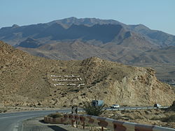
The wilaya of Ouled Djellal is an Algerian province created in 2019, previously, a delegated wilaya created in 2015. It is in the Algerian Sahara.
Geography
The wilaya of Ouled Djellal is located in the Algerian Sahara, its area 131,220 km² .
It is delimited by:
- to the north by the M'sila Province;
- to the east by the Biskra Province and El M'Ghair Province;
- to the west by the Djelfa Province;
- and to the south by the Ouargla Province.
History
The wilaya of Ouled Djellal was created on November 26, 2019 .
Previously, it was a delegated wilaya, created according to the law n° 15–140 of May 27, 2015, creating administrative districts in certain wilayas and fixing the specific rules related to them, as well as the list of municipalities that are attached to it. Before 2019, it was attached to the Biskra Province.
Organization of the wilaya
During the administrative breakdown of 2015, the delegated wilaya of Ouled Djellal is made up of 3 communes and 2 Districts
- Ouled Djella
- Sidi Khaled
List of walis
References
 Algeria portal

- ^ Office National des Statistiques, Recensement General de la Population et de l’Habitat 2008 Archived July 24, 2008, at the Wayback Machine Preliminary results of the 2008 population census. Accessed on July 2, 2008.
Places adjacent to Ouled Djellal Province | |
|---|---|


- v
- t
- e
- Adrar (01)
- Chlef (02)
- Laghouat (03)
- Oum El Bouaghi (04)
- Batna (05)
- Béjaïa (06)
- Biskra (07)
- Béchar (08)
- Blida (09)
- Bouira (10)
- Tamanrasset (11)
- Tébessa (12)
- Tlemcen (13)
- Tiaret (14)
- Tizi Ouzou (15)
- Algiers (16)
- Djelfa (17)
- Jijel (18)
- Sétif (19)
- Saïda (20)
- Skikda (21)
- Sidi Bel Abbès (22)
- Annaba (23)
- Guelma (24)
- Constantine (25)
- Médéa (26)
- Mostaganem (27)
- M'Sila (28)
- Mascara (29)
- Ouargla (30)
- Oran (31)
- El Bayadh (32)
- Illizi (33)
- Bordj Bou Arréridj (34)
- Boumerdès (35)
- El Taref (36)
- Tindouf (37)
- Tissemsilt (38)
- El Oued (39)
- Khenchela (40)
- Souk Ahras (41)
- Tipaza (42)
- Mila (43)
- Aïn Defla (44)
- Naâma (45)
- Aïn Témouchent (46)
- Ghardaïa (47)
- Relizane (48)
- Bordj Baji Mokhtar (49)
- In Salah (50)
- Djanet (51)
- In Guezzam (52)
- El M'Ghair (53)
- Touggourt (54)
- Béni Abbès (55)
- Timimoun (56)
- Ouled Djellal (57)
- El Menia (58)


