Olaine Municipality
Municipality of Latvia
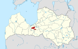
Municipality in Latvia
Olaine Municipality Olaines novads | |
|---|---|
 Flag  Coat of arms | |
 | |
| Country |  Latvia Latvia |
| Formed | 2009 |
| Centre | Olaine |
| Government | |
| • Council Chair | Andris Bergs (LSDSP) |
| Area | |
| • Total | 308.68 km2 (119.18 sq mi) |
| • Land | 297.15 km2 (114.73 sq mi) |
| • Water | 11.53 km2 (4.45 sq mi) |
| Population (2023)[2] | |
| • Total | 20,505 |
| • Density | 66/km2 (170/sq mi) |
| Website | www |
Olaine Municipality (Latvian: Olaines novads) is a municipality in Latvia. The municipality was formed in 2009 by merging Olaine parish and Olaine town the administrative centre being Olaine. The population in 2020 was 19,667.[3]
After the 2021 administrative reform, a part of Ķekava Parish of Ķekava Municipality (near the village of Jāņupe) was added to connect both of the separated areas of the municipality.
Twin towns — sister cities


Images
-
 Boundaries of the municipality from 2009 to 2021

See also
- Administrative divisions of Latvia (2009)
References
- ^ "Reģionu, novadu, pilsētu un pagastu kopējā un sauszemes platība gada sākumā". Central Statistical Bureau of Latvia. Retrieved 18 January 2023.
- ^ "Iedzīvotāju skaits pēc tautības reģionos, pilsētās, novados, pagastos, apkaimēs un blīvi apdzīvotās teritorijās gada sākumā (pēc administratīvi teritoriālās reformas 2021. gadā) 2021 - 2022". Central Statistical Bureau of Latvia. Retrieved 2 October 2023.
- ^ "ISG020. Population number and its change by statistical region, city, town, 21 development centres and county". Central Statistical Bureau of Latvia. 2020-01-01. Retrieved 2021-02-12.
- ^ "Olaines novada – Attīstības programma 2014. – 2020. gadam" (PDF). olaine.lv (in Latvian). Olaine. p. 63. Retrieved 2019-08-31.

Authority control databases | |
|---|---|
| National |
|
| Geographic |
|
56°46′20″N 24°00′07″E / 56.7722°N 24.0019°E / 56.7722; 24.0019
 | This Vidzeme location article is a stub. You can help Wikipedia by expanding it. |
- v
- t
- e


