Micia


Location within Romania
- Castra of Mintia
- Castra of Vețel
- vexill. XIII Gemina
- vexill. IV Flavia Felix[1]
 Romania
 National Historical Monument
Micia was initially a large Roman fort for auxiliary troops outside which a large town developed. The archaeological site is located in the municipality of Vețel (Witzel), Hunedoara County in Transylvania, Romania.
It was important as it monitored and secured the road to the centre of Transylvania and the river route along the frontier to Partiscum, today Szeged, Hungary as well as supervising the adjacent mining area. In addition, there was a strategically important river port.
In the civil settlement were large baths and a small amphitheatre. The large number of ancient inscriptions are significant.

Castra
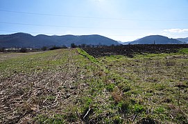
It had a quadrilateral shape of 360 x 180 m placed unusually with the long sides to the east/west unlike traditionally with the narrow side facing the enemy. It lies across the modern road and railway.
-
 View from thermae (2014)
 -
 Nordic vallum of the fort (2014)
 -
 Eastern vallum of the fort (2014)
 -
 Western vallum of the fort (2014)
 -
 The plan of castra


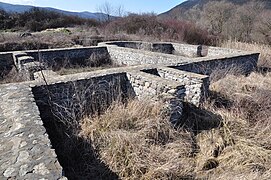
Vicus
-
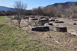 Buildings (2014)
 -
 Buildings (2014)
 -
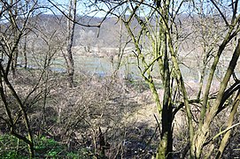 The Marisus river north of the vicus (2014)


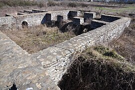
Thermae
-
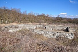 Thermae (2014)
 -
 Thermae (2014)
 -
 Thermae (2014)


Amphitheatre
100 m to the southeast of the military bath is a small amphitheatre with a circumference of 104 m. The arena was of diameter 31 × 29 m.[5]
-
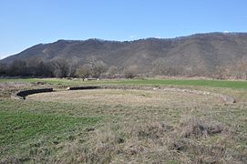 amphitheatre (2014)
 -
 plan of amphitheatre


Necropolis
-
 Funerary monument, 2nd century AD.
 -
 Funerary monument, 2nd century AD.


References
- ^ a b c "Micia". Archived from the original on 2012-11-16. Retrieved 2014-03-05.
- ^ a b Țentea, Ovidiu (2012). EX ORIENTE AD DANUBIUM - The Syrian units on the Danube frontier of the Roman Empire. MEGA Publishing House. Retrieved 2014-03-17.
- ^ a b c Tactică, strategie și specific de luptă la cohortele equitate din Dacia Romană, Petru Ureche[permanent dead link]
- ^ a b "Situl arheologic de la Veţel-Micia". National Archaeological Record of Romania (RAN). ran.cimec.ro. 2013-06-06. Archived from the original on 2014-03-04. Retrieved 2014-02-04.
- ^ Russell L. Sturzebecker: Photo Atlas. Athletic-Cultural Archaeological Sites in the Greco-Roman World. Europe, North Africa & the Middle East. Russell L. Sturzebecker, West Chester, PA 1985. ISBN 0-9600466-2-3. p. 349.
See also
External links
 Media related to Castra Micia at Wikimedia Commons
- Roman castra from Romania - Google Maps / Earth Archived 2012-01-17 at the Wayback Machine


