Machrie
Human settlement in Scotland

Machrie
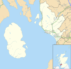
Location within North Ayrshire
- Kilmory
- North Ayrshire
- Ayrshire and Arran
- North Ayrshire and Arran
- Cunninghame North
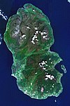
Machrie (Scottish Gaelic: Am Machaire) is a village on the Isle of Arran in the Firth of Clyde, Scotland. Machrie Bay can be found on the West Coast. The village is within the parish of Kilmory.[1]
It is most well known for its Standing Stones that are a local tourist attraction, along with the King's Cave which was believed to have been used by Robert the Bruce.
Machrie Moor
Machrie Moor is the site of a number of neolithic structures dating back up to 4500 years ago. These include the six Machrie Moor Stone Circles, and Moss Farm Road Stone Circle. The standing stones were dated back to approximately 2500 years ago but excavations in the 1980s uncovered elaborate timber structures and stone circles which dated back even further in history.
References
- ^ "Details of Machrie". Scottish Places. Retrieved 30 December 2014.
External links
Wikimedia Commons has media related to Machrie.
Wikimedia Commons has media related to Machrie Moor.
- Machrie Bay Website
- v
- t
- e
- Brodick Castle
- Lochranza Castle
- Kildonan Castle
- Hutton's Unconformity
- Bruce's Castle
- Holy Island
- Pladda
- Hamilton Isle
- Islands of the Clyde
 | This North Ayrshire location article is a stub. You can help Wikipedia by expanding it. |
- v
- t
- e


