List of streets in Ponce, Puerto Rico

This article provides a listing, with brief descriptions, of the most traveled or best known streets and thoroughfares in Ponce, Puerto Rico. Unless otherwise noted, traffic is two-way. If traffic is two-way for the entire length of the street (as opposed to just a portion of its length), it is designated with the symbol "↔" under the column "Traffic direction"; otherwise, the dash symbol ("–") is used.
List of streets
| Name | Southern or western terminus | Northern or eastern terminus | Length, mi (km) | No. of lanes | Traffic direction | Notes | Photo |
|---|---|---|---|---|---|---|---|
| Avenida Fagot | Bulevar Miguel Pou | Puerto Rico Highway 10 | 3.0 (4.8)[a] | 4 | S ↔ N | Southern terminus becomes Avenida Las Américas at Bulevar Miguel Pou |  |
| Avenida Hostos[b] | Plaza de Recreo de la Playa | Calle Ferrocarril | 2.5 (4.0)[a] | 2 | S ↔ N | — |  |
| Avenida Las Américas | Puerto Rico Highway 500 (Puente San Antonio[2]) | Bulevar Miguel Pou | 3.0 (4.8) | 6 | W ↔ E | Northern terminus becomes Avenida Fagot at Bulevar Miguel Pou |  |
| Avenida Muñoz Rivera | Puerto Rico Highway 2 | Avenida Las Américas | 0.5 (0.80)[a] | 2 | S ↔ N | — |  |
| Avenida Santiago de los Caballeros | Port of Ponce | Avenida Tito Castro | 3.28 (5.28) | 4–6 | S ↔ N | Some segments are 4 lanes only |  |
| Avenida Tito Castro | Puerto Rico Highway 12 | Puerto Rico Highway 139 | 3.0 (4.8)[a] | 4 | W ↔ E | Becomes Calle Betances at the bridge over Río Portugués, where it becomes a one-lane, westbound street |  |
| Bulevar Miguel Pou | Parque del Tricentenario / Puente de los Leones | Avenida Ednita Nazario | 1.5 (2.4)[a] | 4[c] | W ↔ E | Eastern end turns into Ponce Bypass. |  |
| Calle Atocha | Calle Isabel | Calle Victoria | 0.1 (0.16)[a] | 1 | S – N | Traffic is one-way northbound. | 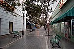 |
| Calle Cantera (a.k.a. Calle Mayor Cantera) | Calle Marina | Puerto Rico Highway 10 | 0.5 (0.80)[a] | 2 | N – S | Traffic is one-way southbound from Calle Tricoche (i.e., 1 block north of PR-14) to Calle Marina (i.e., PR-123) |  |
| Calle Comercio | Plaza Las Delicias | Avenida Santiago de los Caballeros | 1.2 (1.9)[a] | 1–2 | W – E | Traffic is eastbound from Plaza Las Delicias to Calle Cruz |  |
| Calle Isabel | Plaza Muñoz Rivera | Parque del Tricentenario | 0.4 (0.64)[a] | 1–2 | E – W | Except for the one block from Plaza Muñoz Rivera to Calle León, traffic is one-way westbound. |  |
| Calle Marina | Calle Ferrocarril | Plaza Las Delicias | 0.4 (0.64)[a] | 1–2 | S – N | Traffic is northbound one-way north of Calle Mayor to Plaza Las Delicias; South of Calle Mayor traffic is two-way; Southern end becomes Avenida Hostos at Calle Ferrocarril |  |
| Calle Villa | Bridge over Río Cañas at entrance to Urbanización Jardines del Caribe | Plaza Las Delicias | 2.0 (3.2) | 2 | W – E | Traffic is eastbound one-way from Carretera Pámpanos to Plaza Las Delicias |  |
| Calle 25 de Enero | Calle Villa | Residencial Santiago Iglesias | unknown | 1 | N – S | — |  |
| Carretera Pámpanos | Puerto Rico Highway 2 | Calle Villa | 1.0 (1.6)[a] | 2 | S ↔ N | — |  |
| Ponce Bypass | Carretera Pámpanos | Avenida Ednita Nazario | 4.0 (6.4)[a] | 6 | W ↔ E | Eastern end becomes Bulevar Miguel Pou. |  |
- ^ a b c d e f g h i j k l Estimated length
- ^ Avenida Hostos was previously known as Camino Real. On 11 September 1903, it was renamed Avenida Eugenio María de Hostos.[1]
- ^ Six (6) lanes when both frontage roads (or Calle Marginal) are considered.
See also
 Puerto Rico portal

References
- ^ Eli D. Oquendo-Rodríguez. Pablo L. Crespo-Vargas, editor. "A Orillas del Mar Caribe: Boceto histórico de la Playa de Ponce - Desde sus primeros habitantes hasta principios del siglo XX." First edition. June 2017. Editorial Akelarre. Centro de Estudios e Investigaciones del Sur Oeste de Puerto Rico (CEISCO). Lajas, Puerto Rico. Page 48. ISBN 978-1547284931
- ^ Carmelo Rosario Natal. Ponce En Su Historia Moderna: 1945-2002. Published by Secretaría de Cultura y Turismo of the Government of the Autonomous Municipality of Ponce. Ponce, Puerto Rico. 2003. p. 251.
External links
| External audio | |
|---|---|
 You may see some of the streets in Downtown Ponce HERE You may see some of the streets in Downtown Ponce HERE |
 Media related to Streets in Ponce, Puerto Rico at Wikimedia Commons
- v
- t
- e
- Anón
- Bucaná
- Canas
- Canas Urbano
- Capitanejo
- Cerrillos
- Coto Laurel
- Cuarto
- Guaraguao
- Machuelo Abajo
- Machuelo Arriba
- Magueyes
- Magueyes Urbano
- Maragüez
- Marueño
- Montes Llanos
- Playa
- Portugués
- Portugués Urbano
- Primero
- Quebrada Limón
- Quinto
- Real
- Sabanetas
- San Antón
- San Patricio
- Segundo
- Sexto
- Tercero
- Tibes
- Vayas

- Museo de Arte de Ponce
- Museo Parque de Bombas
- Museo Castillo Serrallés
- Centro Ceremonial Indígena de Tibes
- Museo Hacienda Buena Vista
- Museo Casa Paoli
- Museo de la Masacre de Ponce
- Museo de la Música Puertorriqueña
- Museo del Deporte
- Museo de la Historia de Ponce
- Museo de la Arquitectura Ponceña
- Museo del Autonomismo Puertorriqueño
- Museo Biblioteca RHC
- Panteón Nacional Román Baldorioty de Castro
- Hospital Damas
- Hospital San Lucas
- Hospital Dr. Pila
- Hospital Oncológico Andrés Grillasca
- Hospital San Cristóbal
- Steven Anthony Children's Hospital
- Cardona
- Ratones
- Frío
- Caja de Muertos
- Morrillito
- Gatas
- Jueyes


