List of islands of Hawaii
Native name: Mokupuni o Hawai‘i | |
|---|---|
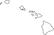
 Location of Hawaii within the United States | |
| Geography | |
| Location | North Pacific |
| Archipelago | Hawaiian Islands |
| Total islands | Approximately 132 Islands (including 4 of the Midway Atoll) |
| Major islands | Hawaiʻi, Maui, Kahoʻolawe. Lānaʻi, Molokaʻi, Oʻahu, Kauaʻi, Niʻihau |
| Area | 6,423 sq mi (16,640 km2) |
| Length | 1,500 mi (2400 km) |
| Coastline | 750 mi (1210 km) |
| Highest point | 13,796 ft (4,205 m) (Mauna Kea) |
| Administration | |
United States | |
| State | Hawaii (excluding the federally governed Midway Atoll) |
| Demographics | |
| Population | 1,455,271 (2020) |
Map all coordinates using OpenStreetMap
Download coordinates as:
- KML
- GPX (all coordinates)
- GPX (primary coordinates)
- GPX (secondary coordinates)
The following is a list of the islands in Hawaii. The state of Hawaii, consisting of the Hawaiian Islands, has the fourth-longest ocean coastline of the 50 states (after Alaska, Florida, and California) at 750 miles (1,210 km). It is the only state that consists entirely of islands, with 6,422.62 sq mi (16,634.5 km2) of land. The Hawaiian Island archipelago extends some 1,500 miles (2,400 km) from the southernmost island of Hawaiʻi to the northernmost Kure Atoll. Despite being within the boundaries of Hawaii, Midway Atoll, comprising several smaller islands, is not included as an island of Hawaii, because it is classified as a United States Minor Outlying Islands and is therefore administered by the federal government and not the state.
Hawaii is divided into five counties: Hawaiʻi, Honolulu, Kalawao, Kauaʻi, and Maui. Each island is included in the boundaries and under the administration of one of these counties. Honolulu County, despite being centralized, administers the outlying Northwestern Hawaiian Islands. Kalawao (the smallest county in the United States in terms of land area) and Maui, both occupying the island of Molokaʻi, are the only counties that share the same island. Hawaii is typically recognized by its eight main islands: Hawaiʻi, Maui, Kahoʻolawe, Lānaʻi, Molokaʻi, Oʻahu, Kauaʻi, and Niʻihau.
The state of Hawaii officially recognizes only 137 islands in the state which includes four islands of the Midway Atoll.[1] An island in this sense may also include much smaller and typically uninhabited islets, rocks, coral reefs, and atolls. For that reason, this article lists 152 separate islands (but also names smaller island chains such as the French Frigate Shoals, which includes 13 islands of its own). Some of these are too small to appear on maps, and others, such as Maro Reef, only appear above the water's surface during times of low tide. Others, such as Shark and Skate islands, have completely eroded away.
The majority of the Hawaiian Islands are uninhabited, with Niʻihau being the westernmost island with a population of around 130 natives, no one else is allowed on the island. All the islands west of Niʻihau—those categorized as the Northwestern Hawaiian Islands—are unpopulated and recently incorporated into the Papahānaumokuākea Marine National Monument. The island of Oʻahu has just over one million residents (about 70% of the state's population), and the island of Hawaiʻi is by far the largest island with an area of 4,028 sq mi (10,430 km2)—62.7% of the state's land area. The islands were first settled as early as AD 300 by Polynesian long-distance navigators. British captain James Cook was the first European to land on the islands in January 1778.[2] The islands, which were governed independently up until 1898 were then annexed by the United States as a territory from 1898 to 1959. On August 21, 1959, they were collectively admitted as the 50th state.
The islands are the exposed peaks of a great undersea mountain range known as the Hawaiian–Emperor seamount chain, formed by volcanic activity over a hotspot in the Earth's mantle. The archipelago formed as the Pacific plate moved slowly northwestward over a hotspot in the mantle at about 32 miles (51 km) per million years. The islands in the northwest of the archipelago are older and typically smaller, due to longer exposure to erosion. The age of the archipelago has been estimated using potassium-argon dating methods.[3] It is estimated that the northwesternmost Kure Atoll is the oldest at approximately 28 million years, while the southeasternmost Hawaiʻi Island is approximately 400,000 years old and still subjected to ongoing volcanism—one of the most active hotspots on Earth.[4][5]
Hawaiʻi County

Map this section's coordinates using OpenStreetMap
Download coordinates as:
- KML
- GPX (all coordinates)
- GPX (primary coordinates)
- GPX (secondary coordinates)
Hawaiʻi County centers on Hawaiʻi Island. With an area of 4,028 sq mi (10,430 km2), it is larger than all of the other islands of Hawaii combined, encompassing approximately 62.7% of the entire state's land area. It is also the largest island in the United States. In modern times, Hawaiʻi is known commonly as the "Big Island" to reduce confusion between the island and the state itself. The island also contains the state's highest peak: Mauna Kea at 13,803 feet (4,207 m). Hawaiʻi County as a whole has 27 islands and a total population of 185,079.
| Island | Coordinates |
|---|---|
| Arched Rock | 19°14′04″N 155°54′03″W / 19.23444°N 155.90090°W / 19.23444; -155.90090 (Arched Rock) |
| Coconut Island (Moku Ola) | 19°43′57″N 155°04′17″W / 19.73250°N 155.07139°W / 19.73250; -155.07139 (Coconut Island) |
| Hawaiʻi | 19°30′02″N 155°30′02″W / 19.50056°N 155.50056°W / 19.50056; -155.50056 (Hawaiʻi Island) |
| Kalaemano | 19°28′48″N 155°56′15″W / 19.48005°N 155.93738°W / 19.48005; -155.93738 (Kalaemano) |
| Kaluahee Rock | 19°17′32″N 155°53′29″W / 19.29222°N 155.89130°W / 19.29222; -155.89130 (Kaluahee Rock) |
| Kaopapa | 19°28′06″N 155°55′30″W / 19.46833°N 155.92500°W / 19.46833; -155.92500 (Kaopapa) |
| Kauhuula | 19°10′51″N 155°25′27″W / 19.18083°N 155.42417°W / 19.18083; -155.42417 (Kauhuula) |
| Kaulaʻināiwi Island | 19°44′06″N 155°04′21″W / 19.73500°N 155.07250°W / 19.73500; -155.07250 (Kaulaʻināiwi Island) |
| Kawelohea | 19°05′09″N 155°33′13″W / 19.08583°N 155.55361°W / 19.08583; -155.55361 (Kawelohea) |
| Keaoi Island | 19°16′15″N 155°15′24″W / 19.27083°N 155.25667°W / 19.27083; -155.25667 (Keaoi Island) |
| Kipu Rock | 19°26′48″N 155°55′24″W / 19.44667°N 155.92333°W / 19.44667; -155.92333 (Kipu Rock) |
| Kuhulu Rock | 19°17′24″N 155°53′33″W / 19.29000°N 155.89250°W / 19.29000; -155.89250 (Kuhulu Rock) |
| Laahana | 19°11′36″N 155°23′58″W / 19.19333°N 155.39944°W / 19.19333; -155.39944 (Laahana) |
| Lepeamoa Rock | 19°20′22″N 155°53′17″W / 19.33944°N 155.88806°W / 19.33944; -155.88806 (Lepeamoa Rock) |
| Mahikea Island | 19°44′16″N 155°01′54″W / 19.73778°N 155.03167°W / 19.73778; -155.03167 (Mahikea Island) |
| Mokuhonu | 18°56′49″N 155°41′52″W / 18.94694°N 155.69778°W / 18.94694; -155.69778 (Mokuhonu) |
| Mokuokahailani Rock | 19°10′57″N 155°26′12″W / 19.18250°N 155.43667°W / 19.18250; -155.43667 (Mokuokahailani Rock) |
| Mokupuku | 20°11′43″N 155°42′09″W / 20.19528°N 155.70250°W / 20.19528; -155.70250 (Mokupuku) |
| Opihi Rock | 19°34′57″N 154°54′53″W / 19.58250°N 154.91472°W / 19.58250; -154.91472 (Opihi Rock) |
| Paʻakea | 18°58′10″N 155°36′52″W / 18.96944°N 155.61444°W / 18.96944; -155.61444 (Paʻakea) |
| Paokalani Island | 20°11′42″N 155°42′19″W / 20.19500°N 155.70528°W / 20.19500; -155.70528 (Paokalani Island) |
| Pohakulua | 19°55′00″N 155°53′51″W / 19.91667°N 155.89750°W / 19.91667; -155.89750 (Pohakulua) |
| Pulehua Island | 18°58′00″N 155°37′23″W / 18.96667°N 155.62306°W / 18.96667; -155.62306 (Pulehua Island) |
| Reeds Island | 19°43′38″N 155°05′53″W / 19.72722°N 155.09806°W / 19.72722; -155.09806 (Reeds Island) |
| Wahinemakanui | 19°39′55″N 154°58′45″W / 19.66528°N 154.97917°W / 19.66528; -154.97917 (Wahinemakanui) |
Honolulu County

Map this section's coordinates using OpenStreetMap
Download coordinates as:
- KML
- GPX (all coordinates)
- GPX (primary coordinates)
- GPX (secondary coordinates)
Known officially as the City and County of Honolulu, the county includes both the urban district of Honolulu (the state's largest city and capital) and the rest of the island of Oʻahu, as well as several minor surrounding islands. The county also administers the Northwestern Hawaiian Islands with the exception of the federal governed Midway Atoll. The county's population in 2010 was 953,207, making it the 43rd most populated county in the United States. At 596.7 sq mi (1,545 km2), the island of Oʻahu is the third largest island and also the most populated, accounting for approximately 70% of the entire state's population. The county as a whole has 63 islands, and 32 of those belong to the Northwestern Hawaiian Islands.
| Island | Coordinates |
|---|---|
| Ahu O Laka Island | 21°27′59″N 157°48′37″W / 21.46639°N 157.81028°W / 21.46639; -157.81028 (Ahu O Laka Island) |
| Banzai Rocks | 21°39′50″N 158°03′35″W / 21.66389°N 158.05972°W / 21.66389; -158.05972 (Banzai Rocks) |
| Coconut Island (Mokuoloe) | 21°26′01″N 157°47′18″W / 21.43361°N 157.78833°W / 21.43361; -157.78833 (Coconut Island) |
| Coral Island | 21°27′01″N 157°47′12″W / 21.45028°N 157.78667°W / 21.45028; -157.78667 (Coral Island) |
| Ford Island | 21°22′00″N 157°57′53″W / 21.36667°N 157.96472°W / 21.36667; -157.96472 (Ford Island) |
| Kaohikaipu Island | 21°19′25″N 157°39′33″W / 21.32361°N 157.65917°W / 21.32361; -157.65917 (Kaohikaipu Island) |
| Khewa Moku | 21°40′32″N 157°55′36″W / 21.67556°N 157.92667°W / 21.67556; -157.92667 (Khewa Moku) |
| Kūkaimanini Island | 21°41′47″N 158°01′26″W / 21.69639°N 158.02389°W / 21.69639; -158.02389 (Kūkaimanini Island) |
| Kahakaʻaulana Island | 21°18′47″N 157°53′53″W / 21.31306°N 157.89806°W / 21.31306; -157.89806 (Kahakaʻaulana Island) |
| Kapapa Island | 21°28′48″N 157°48′05″W / 21.48000°N 157.80139°W / 21.48000; -157.80139 (Kapapa Island) |
| Kekepa Island | 21°27′54″N 157°46′41″W / 21.46500°N 157.77806°W / 21.46500; -157.77806 (Kekepa Island) |
| Kukuihoʻolua | 21°39′12″N 157°54′58″W / 21.65333°N 157.91611°W / 21.65333; -157.91611 (Kukuihoʻolua) |
| Laulaunui Island | 21°22′01″N 158°00′57″W / 21.36694°N 158.01583°W / 21.36694; -158.01583 (Laulaunui Island) |
| Mōkōlea Rock | 21°26′06″N 157°43′20″W / 21.43500°N 157.72222°W / 21.43500; -157.72222 (Mōkōlea Rock) |
| Mānana Island | 21°19′54″N 157°39′35″W / 21.33167°N 157.65972°W / 21.33167; -157.65972 (Mānana Island) |
| Mokauea Island | 21°18′41″N 157°53′42″W / 21.31139°N 157.89500°W / 21.31139; -157.89500 (Mokauea Island) |
| Mokoliʻi | 21°30′46″N 157°49′57″W / 21.51278°N 157.83250°W / 21.51278; -157.83250 (Mokoliʻi) |
| Mokuʻlai | 21°39′07″N 157°54′43″W / 21.65194°N 157.91194°W / 21.65194; -157.91194 (Mokuʻlai) |
| Mokuaia Island | 21°39′57″N 157°55′32″W / 21.66583°N 157.92556°W / 21.66583; -157.92556 (Mokuaia Island) |
| Mokuauia (Goat Island) | 21°39′57″N 157°55′32″W / 21.66583°N 157.92556°W / 21.66583; -157.92556 (Mokuauia) |
| Moku Moʻo | 21°23′33″N 157°48′27″W / 21.39250°N 157.80750°W / 21.39250; -157.80750 (Moku Moʻo) |
| Moku Iki | 21°22′16″N 157°57′01″W / 21.37111°N 157.95028°W / 21.37111; -157.95028 (Moku Iki) |
| Mokulua Islands | 21°23′42″N 157°42′04″W / 21.39500°N 157.70111°W / 21.39500; -157.70111 (Mokulua Islands) |
| Moku Manu | 21°28′23″N 157°43′23″W / 21.47306°N 157.72306°W / 21.47306; -157.72306 (Moku Manu) |
| Mokumanu Islands | 21°28′00″N 157°43′00″W / 21.46667°N 157.71667°W / 21.46667; -157.71667 (Mokumanu Islands) |
| Moku Nui | 21°22′16″N 157°57′08″W / 21.37111°N 157.95222°W / 21.37111; -157.95222 (Moku Nui) |
| Mokuoeo Island | 21°18′44″N 157°54′19″W / 21.31222°N 157.90528°W / 21.31222; -157.90528 (Mokuoeo Island) |
| Oʻahu | 21°26′00″N 157°58′00″W / 21.43333°N 157.96667°W / 21.43333; -157.96667 (Oʻahu) |
| Pōhaku Kulaʻilaʻi | 21°31′48″N 158°13′58″W / 21.53000°N 158.23278°W / 21.53000; -158.23278 (Pōhaku Kulaʻilaʻi) |
| Papaʻamoi Island | 21°42′19″N 158°00′45″W / 21.70528°N 158.01250°W / 21.70528; -158.01250 (Papaʻamoi Island) |
| Popoia Island | 21°24′11″N 157°43′24″W / 21.40306°N 157.72333°W / 21.40306; -157.72333 (Popoia Island) |
| Pulemoku | 21°39′46″N 157°55′05″W / 21.66278°N 157.91806°W / 21.66278; -157.91806 (Pulemoku) |
| Sand Island | 21°18′30″N 157°53′00″W / 21.30833°N 157.88333°W / 21.30833; -157.88333 (Sand Island) |
| Wānanapaoa Islands | 21°38′31″N 158°04′21″W / 21.64194°N 158.07250°W / 21.64194; -158.07250 (Wānanapaoa Islands) |
Northwestern Hawaii Islands

Map this section's coordinates using OpenStreetMap
Download coordinates as:
- KML
- GPX (all coordinates)
- GPX (primary coordinates)
- GPX (secondary coordinates)
The Northwestern Hawaiian Islands (also known as the Leeward Islands) are the small islands and atolls in the Hawaiian island chain located northwest of the larger islands of Kauaʻi and Niʻihau. For administrative purposes, all of these islands are controlled by Honolulu County. The Northwestern Hawaiian Islands consist of nine main islands and innumerable islets, coral reefs, atolls, sandbar, and intermittent islands—some of which are officially named. All of these islands account for only 3.1075 sq mi (8.048 km2) and have no permanent residents.
Midway Atoll, sometimes referred to as Midway Island, is a 2.4 sq mi (6.2 km2) archipelago. For quite some time, it had a permanent population of naval personnel. It is one of the northwesternmost islands, located 161 miles (259 km) east of the International Date Line. Kure Atoll is the only island west at 55 miles (89 km) beyond Midway Atoll. It also observes a different time zone (Samoa Time Zone) than the rest of the Hawaiian Islands. Because of its strong military history, Midway Atoll is classified as a Minor Outlying Island, an unorganized territory of the United States and is therefore not under the jurisdiction of Hawaii. Midway Atoll consists of four individual islands.
- Indicates an island that is part of the Midway Atoll
| Island | Coordinates |
|---|---|
| Bare Island | 23°44′53″N 166°08′53″W / 23.74809°N 166.14808°W / 23.74809; -166.14808 (Bare Island) |
| Bird Island | 27°47′04″N 175°50′10″W / 27.78444°N 175.83611°W / 27.78444; -175.83611 (Bird Island) |
| Disappearing Island | 23°42′58″N 166°08′10″W / 23.71601°N 166.13602°W / 23.71601; -166.13602 (Disappearing Island) |
| Eastern Island | 28°12′35″N 177°19′46″W / 28.20985°N 177.32933°W / 28.20985; -177.32933 (Eastern Island) |
| East Island | 23°44′48″N 166°08′58″W / 23.74675°N 166.14954°W / 23.74675; -166.14954 (East Island) |
| French Frigate Shoals | 23°44′56″N 166°08′46″W / 23.74889°N 166.14611°W / 23.74889; -166.14611 (French Frigate Shoals) |
| Gardner Pinnacles | 25°00′01″N 167°55′00″W / 25.00028°N 167.91667°W / 25.00028; -167.91667 (Gardner Pinnacles) |
| Gin Island | 23°44′13″N 166°08′23″W / 23.73693°N 166.13967°W / 23.73693; -166.13967 (Gin Island) |
| Grass Island | 27°45′55″N 175°54′02″W / 27.76528°N 175.90056°W / 27.76528; -175.90056 (Grass Island) |
| Green Island | 28°23′40″N 178°17′51″W / 28.39444°N 178.29750°W / 28.39444; -178.29750 (Grass Island) |
| Hermes Atoll | 27°50′00″N 175°50′00″W / 27.83333°N 175.83333°W / 27.83333; -175.83333 (Hermes Atoll) |
| Kittery Island | 27°45′28″N 175°56′25″W / 27.75778°N 175.94028°W / 27.75778; -175.94028 (Kittery Island) |
| Kure Atoll | 28°25′00″N 178°20′00″W / 28.41667°N 178.33333°W / 28.41667; -178.33333 (Kure Atoll) |
| Laysan Island | 25°46′15″N 171°44′15″W / 25.77083°N 171.73750°W / 25.77083; -171.73750 (Laysan Island) |
| La Perouse Pinnacle | 23°44′50″N 166°09′32″W / 23.74714°N 166.15881°W / 23.74714; -166.15881 (Le Perouse Pinnacle) |
| Lisianski Island | 26°02′00″N 174°00′01″W / 26.03333°N 174.00028°W / 26.03333; -174.00028 (Lisianski Island) |
| Little Gin Island | 23°44′06″N 166°08′18″W / 23.73489°N 166.13821°W / 23.73489; -166.13821 (Little Gin Island) |
| Little North Island | 27°54′10″N 175°44′16″W / 27.90278°N 175.73778°W / 27.90278; -175.73778 (Little North Island) |
| Maro Reef | 25°24′54″N 170°35′24″W / 25.41500°N 170.59000°W / 25.41500; -170.59000 (Maro Reef) |
| Midway Atoll | 28°14′12″N 177°22′15″W / 28.23660°N 177.37092°W / 28.23660; -177.37092 (Midway Atoll) |
| Mullet Island | 23°45′36″N 166°09′20″W / 23.75987°N 166.15563°W / 23.75987; -166.15563 (Mullet Island) |
| Necker Island | 23°35′00″N 164°42′00″W / 23.58333°N 164.70000°W / 23.58333; -164.70000 (Necker Island) |
| Nihoa | 23°06′00″N 161°58′00″W / 23.10000°N 161.96667°W / 23.10000; -161.96667 (Nihoa) |
| North Island | 27°55′00″N 175°44′00″W / 27.91667°N 175.73333°W / 27.91667; -175.73333 (North Island) |
| Pearl Atoll | 27°50′00″N 175°50′00″W / 27.83333°N 175.83333°W / 27.83333; -175.83333 (Pearl Atoll) |
| Round Island | 23°45′34″N 166°09′26″W / 23.75953°N 166.15714°W / 23.75953; -166.15714 (Round Island) |
| Sand Island1 | 28°12′34″N 177°22′43″W / 28.20955°N 177.37851°W / 28.20955; -177.37851 (Sand Island (Midway Atoll)) |
| Sand Island2 | 27°47′09″N 175°51′40″W / 27.78583°N 175.86111°W / 27.78583; -175.86111 (Sand Island) |
| Seal Island | 27°45′09″N 175°56′05″W / 27.75250°N 175.93472°W / 27.75250; -175.93472 (Seal Island) |
| Shark Island | 23°45′38″N 166°10′00″W / 23.76042°N 166.16679°W / 23.76042; -166.16679 (Shark Island) |
| Skate Island | 23°45′55″N 166°09′28″W / 23.76535°N 166.15765°W / 23.76535; -166.15765 (Skate Island) |
| Spit Island | 28°12′23″N 177°20′59″W / 28.20637°N 177.34967°W / 28.20637; -177.34967 (Spit Island) |
| Southeast Island | 27°46′51″N 175°48′42″W / 27.78083°N 175.81167°W / 27.78083; -175.81167 (Southeast Island) |
| Tern Island | 23°45′45″N 166°09′55″W / 23.76238°N 166.16516°W / 23.76238; -166.16516 (Tern Island) |
| Trig Island | 23°45′52″N 166°09′41″W / 23.76456°N 166.16126°W / 23.76456; -166.16126 (Trig Island) |
| Whale Island | 23°45′57″N 166°09′28″W / 23.76589°N 166.15773°W / 23.76589; -166.15773 (Whale Island) |
| Shallow Island | n/a |
| Near Island | |
| Ocean Island |
Kalawao County
Kalawao County contains no individual islands of its own. With a census population of 90, the county is the country's smallest county in terms of population with 44 fewer residents than Loving County, Texas. At 13.21 sq mi (34.2 km2), it is the smallest county by land area in the United States and is often omitted from maps. Kalawao County shares the island of Molokaʻi with Maui County and occupies only 5% of the island's 260 sq mi (670 km2) and 1.2% of the island's 7,404 residents.
Map this section's coordinates using OpenStreetMap
Download coordinates as:
- KML
- GPX (all coordinates)
- GPX (primary coordinates)
- GPX (secondary coordinates)
| Island | Coordinates |
|---|---|
| Molokai | 21°11′49″N 156°58′02″W / 21.19694°N 156.96722°W / 21.19694; -156.96722 (Molokaʻi (Kalawao County)) |
| Mōkapu | 21°11′12″N 156°55′37″W / 21.18667°N 156.92694°W / 21.18667; -156.92694 (Mākapu Island) |
| Huelo | 21°10′27″N 156°55′09″W / 21.17417°N 156.91917°W / 21.17417; -156.91917 (Huelo) |
| ʻOkala Island | 21°10′40″N 156°55′55″W / 21.17778°N 156.93194°W / 21.17778; -156.93194 (Okala Island) |
Kauaʻi County

Map this section's coordinates using OpenStreetMap
Download coordinates as:
- KML
- GPX (all coordinates)
- GPX (primary coordinates)
- GPX (secondary coordinates)
Kauaʻi County is the northwesternmost county (excluding the Northwestern Hawaiian Islands) in the state. It occupies the two main islands of Kauaʻi and Niʻihau. Kauai is fourth largest island in the Hawaiian archipelago at 562.3 sq mi (1,456 km2). With a population of 58,303 (2000), it holds 99.7% of the county's population of 58,463. The remaining 160 residents reside on Niʻihau. Lehua and Kaʻula are the third and fourth largest islands, although they are very small and uninhabited. Kaʻula is the westernmost of the Hawaiian Islands not included in the Northwestern Hawaiian Island chain. The county as a whole has eight islands.
| Island | Coordinates |
|---|---|
| Kaʻula | 21°39′40″N 160°32′30″W / 21.66111°N 160.54167°W / 21.66111; -160.54167 (Kaʻula) |
| Kalanipuao Rock | 21°52′55″N 159°31′33″W / 21.88194°N 159.52583°W / 21.88194; -159.52583 (Kalanipuao Rock) |
| Kauaʻi | 21°56′37″N 159°29′38″W / 21.94361°N 159.49389°W / 21.94361; -159.49389 (Kauaʻi) |
| Kuakamoku Rock | 21°53′36″N 160°13′11″W / 21.89333°N 160.21972°W / 21.89333; -160.21972 (Kuakamoku Rock) |
| Lehua | 22°01′10″N 160°06′02″W / 22.01944°N 160.10056°W / 22.01944; -160.10056 (Lehua) |
| Mokuaeae | 22°14′16″N 159°24′20″W / 22.23778°N 159.40556°W / 22.23778; -159.40556 (Mokuaeae) |
| Niʻihau | 21°54′24″N 160°08′57″W / 21.90667°N 160.14917°W / 21.90667; -160.14917 (Niʻihau) |
| Puʻukole | 22°00′27″N 160°05′49″W / 22.00750°N 160.09694°W / 22.00750; -160.09694 (Puʻukole) |
Maui County

Map this section's coordinates using OpenStreetMap
Download coordinates as:
- KML
- GPX (all coordinates)
- GPX (primary coordinates)
- GPX (secondary coordinates)
Maui County consists of four of the state's main islands: Maui, Kahoʻolawe, Lānaʻi, and Molokaʻi. With a land area of 1,159.20 sq mi (3,002.3 km2), it had a population of 154,834 in 2000. The island of Maui has the most residents at 117,644 (76% of the county's population). It is also the largest of the county's islands with 727.2 sq mi (1,883 km2) of land—the state's second largest island and the 17th largest in the country. At 44.6 sq mi (116 km2), Kahoʻolawe is the state's largest island with no permanent inhabitants. Lānaʻi has a population of 3,193; Molokaʻi has a population of 7,404. Molokaʻi is the only island in Hawaii that is divided between two counties. With a population of 90, Kalawao County occupies a tiny 13.21 sq mi (34.2 km2) portion on the northern shore of the island. Maui County contains 59 named islands.
| Island | Coordinates |
|---|---|
| Āhole Rock | 20°38′59″N 156°03′27″W / 20.64972°N 156.0575°W / 20.64972; -156.0575 (Āhole Rock) |
| Ālau Island | 20°43′53″N 155°58′49″W / 20.73139°N 155.98028°W / 20.73139; -155.98028 (Alau Island) |
| Aawaiki | 20°57′58″N 156°31′26″W / 20.96611°N 156.52389°W / 20.96611; -156.52389 (Aawaiki) |
| Aawanui | 20°57′50″N 156°31′19″W / 20.96389°N 156.52194°W / 20.96389; -156.52194 (Aawanui) |
| Aluea Rocks | 20°50′58″N 156°07′32″W / 20.84944°N 156.12556°W / 20.84944; -156.12556 (Aluea Rocks) |
| Haukoʻi | 21°10′05″N 156°53′54″W / 21.16806°N 156.89833°W / 21.16806; -156.89833 (Haukoʻi) |
| Hulu Island | 20°57′40″N 156°31′10″W / 20.96111°N 156.51944°W / 20.96111; -156.51944 (Hulu Island) |
| Kaelua | 20°49′51″N 156°05′55″W / 20.83083°N 156.09861°W / 20.83083; -156.09861 (Kaelua) |
| Kahʻlau | 20°53′55″N 156°11′49″W / 20.89861°N 156.19694°W / 20.89861; -156.19694 (Kahʻlau) |
| Kahoʻolawe | 20°33′00″N 156°36′00″W / 20.55000°N 156.60000°W / 20.55000; -156.60000 (Kahoʻolawe) |
| Kalaepohaku | 20°46′56″N 156°27′50″W / 20.78222°N 156.46389°W / 20.78222; -156.46389 (Kalaepohaku) |
| Kanahā Rock | 21°08′02″N 156°42′28″W / 21.13389°N 156.70778°W / 21.13389; -156.70778 (Kanahā Rock) |
| Kaneapua | 20°44′14″N 156°58′08″W / 20.73722°N 156.96889°W / 20.73722; -156.96889 (Kaneapua) |
| Moku o Kau | 20°54′28″N 156°12′38″W / 20.90778°N 156.21056°W / 20.90778; -156.21056 (Moku o Kau) |
| Kauwalu | 20°51′33″N 156°07′56″W / 20.85917°N 156.13222°W / 20.85917; -156.13222 (Kauwalu) |
| Keʻpuka Rock | 20°52′44″N 156°10′31″W / 20.87889°N 156.17528°W / 20.87889; -156.17528 (Keʻpuka Rock) |
| Kukuipalaoa | 21°10′19″N 156°49′51″W / 21.17194°N 156.83083°W / 21.17194; -156.83083 (Kukuipalaoa) |
| Lānaʻi | 20°50′30″N 156°55′04″W / 20.84167°N 156.91778°W / 20.84167; -156.91778 (Lānaʻi) |
| Laupapa Rock | 20°41′31″N 156°00′30″W / 20.69194°N 156.00833°W / 20.69194; -156.00833 (Laupapa Rock) |
| Mākālea Rock | 21°10′43″N 156°53′20″W / 21.17861°N 156.88889°W / 21.17861; -156.88889 (Mākōlea Rock) |
| Mākoholā Island | 21°10′29″N 156°52′46″W / 21.17472°N 156.87944°W / 21.17472; -156.87944 (Mākoholā Island) |
| Mahinanui | 20°59′55″N 156°32′38″W / 20.99861°N 156.54389°W / 20.99861; -156.54389 (Mahinanui) |
| Makoloaka Island | 20°50′29″N 156°07′26″W / 20.84139°N 156.12389°W / 20.84139; -156.12389 (Makoloaka Island) |
| Maui | 20°34′55″N 156°22′30″W / 20.58194°N 156.37500°W / 20.58194; -156.37500 (Maui) |
| Mokeehia Island | 20°59′11″N 156°31′33″W / 20.98636°N 156.52586°W / 20.98636; -156.52586 (Mokeehia Island) |
| Mokuʻula | 20°52′18″N 156°40′40″W / 20.87167°N 156.67778°W / 20.87167; -156.67778 (Mokuʻula) |
| Mokuhālua | 20°52′00″N 156°09′14″W / 20.86667°N 156.15389°W / 20.86667; -156.15389 (Mokuhālua) |
| Mokuhala | 20°51′43″N 156°08′12″W / 20.86194°N 156.13667°W / 20.86194; -156.13667 (Mokuhala) |
| Mokuhoʻoniki | 21°08′09″N 156°42′21″W / 21.13583°N 156.70583°W / 21.13583; -156.70583 (Mokuhoʻoniki) |
| Mokuhuki | 20°49′51″N 156°07′06″W / 20.83083°N 156.11833°W / 20.83083; -156.11833 (Mokuhuki) |
| Mokulau | 20°38′24″N 156°06′48″W / 20.64000°N 156.11333°W / 20.64000; -156.11333 (Mokulau) |
| Mokumana | 20°51′46″N 156°08′01″W / 20.86278°N 156.13361°W / 20.86278; -156.13361 (Mokumana) |
| Mokumanu | 21°10′21″N 156°53′28″W / 21.17250°N 156.89111°W / 21.17250; -156.89111 (Mokumanu) |
| Mokupala | 20°42′27″N 155°59′47″W / 20.70750°N 155.99639°W / 20.70750; -155.99639 (Mokupala) |
| Mokupapa1 | 20°39′03″N 156°03′39″W / 20.65083°N 156.06083°W / 20.65083; -156.06083 (Mokupapa) |
| Mokupapa2 | 20°49′41″N 156°04′58″W / 20.82806°N 156.08278°W / 20.82806; -156.08278 (Mokupapa) |
| Mokupapapa | 21°09′45″N 156°43′58″W / 21.16250°N 156.73278°W / 21.16250; -156.73278 (Mokupapapa) |
| Mokupipi | 20°49′40″N 156°04′57″W / 20.82778°N 156.08250°W / 20.82778; -156.08250 (Mokupipi) |
| Molokaʻi | 20°43′53″N 155°58′49″W / 20.73139°N 155.98028°W / 20.73139; -155.98028 (Molokaʻi) |
| Molokini | 20°38′01″N 156°29′50″W / 20.63361°N 156.49722°W / 20.63361; -156.49722 (Molokini) |
| Moku Naio | 20°44′28″N 156°58′10″W / 20.74111°N 156.96944°W / 20.74111; -156.96944 (Moku Naio) |
| Namoku | 21°12′31″N 156°59′17″W / 21.20861°N 156.98806°W / 21.20861; -156.98806 (Namoku) |
| Nanahoa | 20°49′43″N 156°59′43″W / 20.82861°N 156.99528°W / 20.82861; -156.99528 (Nanahoa) |
| Pāʻāonuʻakea | 21°10′00″N 156°54′01″W / 21.16667°N 156.90028°W / 21.16667; -156.90028 (Pāʻāonuʻakea) |
| Pai Island | 20°49′14″N 156°04′09″W / 20.82056°N 156.06917°W / 20.82056; -156.06917 (Pai Island) |
| Papaloa | 20°45′32″N 155°58′53″W / 20.75889°N 155.98139°W / 20.75889; -155.98139 (Papaloa) |
| Papanui o Kane | 20°56′55″N 156°16′50″W / 20.94861°N 156.28056°W / 20.94861; -156.28056 (Papanui o Kane) |
| Pohaku Manamana | 20°35′00″N 156°20′37″W / 20.58333°N 156.34361°W / 20.58333; -156.34361 (Pohaku Manamana) |
| Pohaku Paea | 20°35′53″N 156°26′09″W / 20.59806°N 156.43583°W / 20.59806; -156.43583 (Pohaku Paea) |
| Poopoo | 20°44′19″N 156°55′25″W / 20.73861°N 156.92361°W / 20.73861; -156.92361 (Poopoo) |
| Puāukiʻi Island | 20°45′37″N 155°58′57″W / 20.76028°N 155.98250°W / 20.76028; -155.98250 (Puʻukiʻi Island) |
| Puāukoaʻe | 20°30′50″N 156°36′48″W / 20.51389°N 156.61333°W / 20.51389; -156.61333 (Puʻukoaʻe) |
| Puupehe | 20°44′15″N 156°53′35″W / 20.73750°N 156.89306°W / 20.73750; -156.89306 (Puupehe) |
| Twin Rocks | 20°45′43″N 155°58′48″W / 20.76194°N 155.98000°W / 20.76194; -155.98000 (Twin Rocks) |
| Waiʻāpae | 20°37′40″N 156°12′37″W / 20.62778°N 156.21028°W / 20.62778; -156.21028 (Waiʻāpae) |
| Waiakapuhi | 20°34′48″N 156°22′01″W / 20.58000°N 156.36694°W / 20.58000; -156.36694 (Waiakapuhi) |
References
- ^ "Hawai'i Facts & Figures" (PDF). State of Hawaii Department of Business, Economic Development & Tourism. December 2022. Retrieved January 1, 2023.
- ^ Paul Capper. "Chronology: The Third Voyage (1776–1780)". The Captain Cook Society. Retrieved March 2, 2010.
- ^ "Tectonics, geochronology, and origin of the Hawaiian-Emperor Volcanic Chain" (PDF). The Geology of North America, Volume N: The Eastern Pacific Ocean and Hawaii. The Geology Society of America. 1989. Archived from the original (PDF) on June 11, 2011. Retrieved January 17, 2011.
- ^ McDougall, Ian; Swanson, D. A. (1972). "Potassium-Argon Ages of Lavas from the Hawi and Pololu Volcanic Series, Kohala Volcano, Hawaii". Geological Society of America Bulletin. 83 (12): 3731–3738. doi:10.1130/0016-7606(1972)83[3731:PAOLFT]2.0.CO;2. ISSN 0016-7606. Retrieved January 17, 2011.
- ^ Clague, David A.; Dalrymple, G. Brent; Moberly, Ralph (1975). "Petrography and K-Ar Ages of Dredged Volcanic Rocks from the Western Hawaiian Ridge and the Southern Emperor Seamount Chain". Geological Society of America Bulletin. 86 (7): 991–998. doi:10.1130/0016-7606(1975)86<991:PAKAOD>2.0.CO;2. ISSN 0016-7606. Retrieved January 17, 2011.
External links
- Hawaii Place Names
- v
- t
- e
State of Hawaii
Honolulu (capital)
- Outline
- Constitution
- Delegations
- Discovery and settlement
- Earthquakes
- Geography
- Government
- Hawaiianization
- History
- Hurricanes
- Islands
- Kūʻē Petitions
- Music
- Native Hawaiians
- ʻŌlelo Hawaiʻi (Hawaiian Language)
- Parks
- Pearl Harbor National Memorial
- USS Arizona
- People
- State symbols
- Tourism
- Transportation
- Unification
Islands
 Hawaii portal


