Lichtaard
Village in Friesland, Netherlands
53°19′32″N 5°54′46″E / 53.32556°N 5.91278°E / 53.32556; 5.91278 Netherlands
 Friesland
 (2021)[1]
9176[1]
Lichtaard is a village in Noardeast-Fryslân in the province of Friesland, the Netherlands. It had a population of around 76 in January 2017.[3] Before 2019, the village was part of the Ferwerderadiel municipality.[4]
History
The village was first mentioned in 944 as Lihdanfurt. Lichtaard means "light terp.[5] Lichtaard is a terp (artificial living hill) village with two terps. The terp on which the church is built, dates from before Christ. The church dates from the Middle Ages, but has been extensively modified around 1642.[4]
Lichtaard used to have a school as early as 1677. In 1830, a new school was built, however the school closed in 1882 due to lack of students. In 1840, Lichtaard was home to 89 people.[4]
Gallery
-
 View on Lichtaard
 -
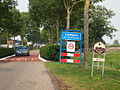 Welcome to Lichtaard


References
- ^ a b c "Kerncijfers wijken en buurten 2021". Central Bureau of Statistics. Retrieved 1 April 2022.
- ^ "Postcodetool for 9176GE". Actueel Hoogtebestand Nederland (in Dutch). Het Waterschapshuis. Retrieved 1 April 2022.
- ^ Aantal inwoners per woonplaats in Ferwerderadiel op 1 januari 2017 Archived 2017-10-21 at the Wayback Machine - Ferwerderadiel
- ^ a b c "Lichtaard". Plaatsengids (in Dutch). Retrieved 1 April 2022.
- ^ "Lichtaard - (geografische naam)". Etymologiebank (in Dutch). Retrieved 1 April 2022.
External links
![]() Media related to Lichtaard at Wikimedia Commons
Media related to Lichtaard at Wikimedia Commons
- v
- t
- e
Populated places in the municipality of Noardeast-Fryslân
- Dokkum
- Former municipalities: Dongeradeel
- Ferwerderadiel
- Kollumerland en Nieuwkruisland
- Aalsum
- Anjum
- Augsbuurt
- Blije
- Bornwird
- Brantgum
- Burdaard
- Burum
- Ee
- Engwierum
- Ferwert
- Foudgum
- Ginnum
- Hallum
- Hantum
- Hantumhuizen
- Hegebeintum
- Hiaure
- Holwerd
- Jannum
- Jislum
- Jouswier
- Kollum
- Kollumerpomp
- Kollumerzwaag
- Lichtaard
- Lioessens
- Marrum
- Metslawier
- Moddergat
- Morra
- Munnekezijl
- Nes
- Niawier
- Oosternijkerk
- Oostmahorn
- Oostrum
- Oudwoude
- Paesens
- Raard
- Reitsum
- Ternaard
- Triemen
- Veenklooster
- Waaxens
- Wânswert
- Warfstermolen
- Westergeest
- Wetsens
- Wierum
- Zwagerbosch
- Bartlehiem (partially)
- Betterwird
- Hantumeruitburen
- Westernijtsjerk
 | This Friesland location article is a stub. You can help Wikipedia by expanding it. |
- v
- t
- e


