Lanyang River
River in Taiwan


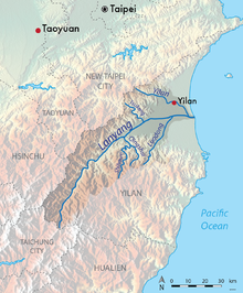
Lanyang River in Taiwan
• location
• coordinates
The Lanyang River (Chinese: 蘭陽溪; pinyin: Lányáng Xī) is a river in northeast Taiwan.[1][2]
Geology
The river flows through Yilan County for 73 kilometers. It has a drainage basin area of 978 km2 with maximum peak flow of 5,420 m3/s.[3]
See also
References
- ^ "Geography & demographics". The Republic of China Yearbook 2015. Executive Yuan. 2015. pp. 40–53. ISBN 978-986-04-6013-1. Archived from the original on 2016-05-31. Retrieved 2016-05-01.
- ^ "Geographic Environment: The Main River of Lanyang Plain". Yilan County Government. 11 May 2016. Retrieved 19 June 2016.
- ^ "Lanyang River".
Wikimedia Commons has media related to Lanyang River.
- v
- t
- e


