Lampa Province
Province in Puno, Peru

Coat of arms
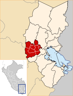
Location of Lampa in the Puno Region
(2019-2022)
Lampa province is a province of the Puno Region in Peru. Its population is about 40,856. The capital is Lampa.[1]
Geography
The Sillapaka mountain range traverses the province. Some of the highest mountains of the province are listed below:[2]
- Amayani
- Anka Wachana
- Anta Q'awa
- Aqu P'ukru
- Awallani
- Chata
- Chunkara
- Chuqi
- Chuqi Pirwa
- Ch'ulla Rinri
- Hatun Pastu
- Hatun Q'asa
- Illani
- Janq'uyu
- Jayu Laqhi
- Kimsa Chata
- Kimsa Chuta
- Kirani
- Kuntur Ikiña
- Kuntur Puñuna
- Kuntur Sayana
- Kuntur Uma
- Kuntur Wasi
- Kunturi
- Lamparasi
- Luntu Luntuni
- Machu Kunturi
- Mamañawi
- Mich'i Mich'ini
- Pachakutiq
- Pariwana
- Pichaqani
- Puka Punchu
- Pukara
- Phisqa Tira
- P'isqi Punta
- Qaqa Chupa
- Qillqa
- Qillwayuq
- Qullqa Sirka
- Qullqi
- Quylluni
- Q'atawini
- Sayt'u
- T'akra
- Urqun Thaki
- Uturunqani
- Wankara
- Wankarani
- Warmi Sayana
- Waykira
- Willuni
- Wini Wini
- Wira Apachita
- Wisa Wisa
- Yanawara (Ananta)
- Yanawara (Palca-Paratía)
- Yanawara (Paratía)
- Yaritayuq
- Yuraq Apachita
Political division
The province has an area of 5,791.73 square kilometers (2,236.20 sq mi) and is split into ten districts.
Ethnic groups
The people in the province are mainly indigenous citizens of Quechua descent. As of 2007[update], Quechua was the first language of 74.56% of the population; Spanish of 24.84%; and Aymara of 0.37%.[3]
See also
- Intikancha
- La Raya mountain range
- Pukaqucha
- Pukara
- Pukarani
- Sayt'uqucha
- Suyt'uqucha
References
- ^ (in Spanish) Municipalidad Provincial de Lampa, Municipalidad Provincial de Lampa, Retrieved November 8, 2007.
- ^ escale.minedu.gob.pe - UGEL map of the Lampa Province (Puno Region)
- ^ 2007 Peru Census, inei.gob.pe Archived 2013-01-27 at the Wayback Machine INEI, Peru, Censos Nacionales 2007
External links
- (in Spanish) Official website

Authority control databases | |
|---|---|
| International |
|
| National |
|
15°25′S 70°35′W / 15.417°S 70.583°W / -15.417; -70.583
 | This Puno Region geography article is a stub. You can help Wikipedia by expanding it. |
- v
- t
- e


