Kotto River
River in Basse-Kotto, Central African Republic


• location
• coordinates
The Kotto River (or Koto River) is a tributary of the Oubangui River in the Central African Republic.
Its source is on the south side of the Bongo Massif, near Mount Toussoro on the border between the Central African Republic and Sudan. It flows generally north-east to south-west for 640 km (400 mi) past Bria, joining the Ubangi River 100 km (60 mi) east of Mobaye. The river separates the Tondou Massif from the Mongos chain to the north. There are several rapids along its course.[2]
The Kotto River gives its name to two of the Central African Republic's sixteen prefectures, Haute-Kotto and Basse-Kotto.
- Historical views
-
 Steamboat on the Kotto.
 -
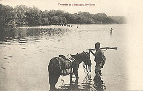 Crossing of the Boungou, a right tributary.


References
- ^ a b c d GRDC station information for Kembe
- ^ "Kotto River | river, north-central Africa | Britannica.com". britannica.com. Retrieved 2017-03-26.
| Authority control databases |
|
|---|
- v
- t
- e


