Keles, Uzbekistan
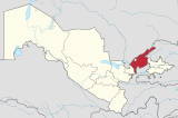
Place in Tashkent Region, Uzbekistan
41°24′12″N 69°12′24″E / 41.40333°N 69.20667°E / 41.40333; 69.20667 Uzbekistan
 (2016)
Keles is a satellite town, located 2 kilometers north-northwest from Tashkent, Uzbekistan. It is the administrative center of Tashkent District (tuman) of Tashkent Region (viloyat).[2] Its population is 30,600 (2016).[3] The river Keles, a tributary of the Syr Darya, flows north of the town.
References
- ^ "КЕЛЕС" (in Russian). Энциклопедический словарь. Retrieved 2012-09-07.
- ^ "Classification system of territorial units of the Republic of Uzbekistan" (in Uzbek and Russian). The State Committee of the Republic of Uzbekistan on statistics. July 2020.
- ^ Soliyev, A.S. Shaharlar geografiyasi [Geography of cities] (PDF) (in Uzbek). p. 146.
- v
- t
- e
Tashkent Region
Capital: Nurafshon
- Angren City
- Bekabad City
- Chirchiq City
- Nurafshon City
- Ohangaron City
- Olmaliq City
- Yangiyoʻl City
- Bekabad
- Boʻka
- Boʻstonliq
- Chinoz
- Ohangaron
- Oqqoʻrgʻon
- Oʻrtachirchiq
- Parkent
- Piskent
- Qibray
- Quyichirchiq
- Tashkent
- Yangiyoʻl
- Yuqorichirchiq
- Zangiota
- Boʻzsuv
- Burchmullo
- Chigirik
- Chorvoq
- Eshonguzar
- Gulbahor
- Iskandar
- Krasnogorsk
- Nurobod
- Olimkent
- Olmazor
- Oʻrtaovul
- Qibray
- Salar
- Tuyaboʻgʻiz
- Xoʻjakent
- Yangi Chinoz
- Yangibozor, Tashkent Region
- Yangihayot
- Zafar
 Tashkent portal
 | This Uzbekistan location article is a stub. You can help Wikipedia by expanding it. |
- v
- t
- e


