Kalewa Township
Township in Sagaing Region, Burma
23°12′N 94°18′E / 23.200°N 94.300°E / 23.200; 94.300 Burma
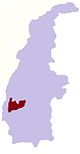
BurmaKalewa Township is a township of Kale District in Sagaing Division of western Burma (Myanmar). The principal town and administrative seat is Kalewa. The Paluzawa coalmines are located in Kalewa township.[1]
Borders
Kalewa Township is bordered[2] by:
- Mawlaik Township, to the north,
- Kyunhla Township, to the east,
- Mingin Township, to the south, and
- Kale (Kalemyo Township), to the west.
Towns and villages
Auktawgyi, Chaungzon, Chingyaung, Gaundi, Gazet, Hintin, Hkonbyin, Hmangon, Indaing, Ingon, Inmatin, Kado, Kaing, Kaing Shwedaung, Kalewa, Kanni, Kazet, Kongyi, Kunbyo, Kyauktan, Kyaunggyigon, Kyawdaw, Kyawzin, Kyudaw Chaungzon, Kywegu, Kywegyan, Kywenan, Laungmin, Legyidaw, Letpannginaung, Manpagale, Mankaw, Masein, Matu, Mutaik, Myittha, Nammaw, Nanmawke, Naungput, Nwedan, Paga, Pagyizu, Paluzawa, Paunggyaung, Pawlaw, Sabagyi, Segyi, Shan-in, Shwedaung, Shwegyin, Shwewagaw, Sinaingma, Singaung, Sizwe, Tadichaungwa, Taya, Thanbaya, Thetkegyin, Thingan, Tunhlaw, Webon, Welon, Wetto, Yawzu, Ywatha Kyawe That
Notes
- ^ "Tun Thwin Mining Co., Ltd.", accessed 27 December 2009
- ^ "Myanmar States/Divisions & Townships Overview Map" Archived 3 December 2010 at the Wayback Machine Myanmar Information Management Unit (MIMU)
External links
- "Kalewa Google Satellite Map and Gazetteer" map of administrative area with listing of principal settlements, from Maplandia
- v
- t
- e
 Kalewa Township of the Sagaing Region
Capital: Kalewa
- Auktawgyi
- Chaungzon
- Chingyaung
- Gaundi
- Gazet
- Hintin
- Hkonbyin
- Hmangon
- Indaing
- Ingon
- Inmatin
- Kado
- Kaing
- Kaing Shwedaung
- Kalewa
- Kanni
- Kazet
- Kongyi
- Kunbyo
- Kyauktan
- Kyaunggyigon
- Kyawdaw
- Kyawzin
- Kyudaw Chaungzon
- Kywegu
- Kywegyan
- Kywenan
- Laungmin
- Legyidaw
- Letpannginaung
- Manpagale
- Mankaw
- Masein
- Matu
- Mutaik
- Myittha
- Nammaw
- Nanmawke
- Naungput
- Nwedan
- Paga
- Pagyizu
- Paluzawa
- Paunggyaung
- Pawlaw
- Sabagyi
- Segyi
- Shan-in
- Shwedaung
- Shwegyin
- Shwewagaw
- Sinaingma
- Singaung
- Sizwe
- Tadichaungwa
- Taya
- Thanbaya
- Thetkegyin
- Thingan
- Tunhlaw
- Webon
- Welon
- Wetto
- Yawzu
- Ywatha


  | This Kale District location article is a stub. You can help Wikipedia by expanding it. |
- v
- t
- e


