Iyo-Ōhira Station
Railway station in Iyo, Ehime Prefecture, Japan
33°42′58″N 132°42′31″E / 33.7162°N 132.7086°E / 33.7162; 132.7086| Preceding station | Following station | |||
|---|---|---|---|---|
| Iyo-Nakayama U08 towards Uwajima | Yosan Line | Mukaibara U06 S06 towards Takamatsu | ||
Location | |
|---|---|
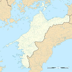  Iyo-Ōhira Station Location within Ehime Prefecture Show map of Ehime Prefecture Iyo-Ōhira Station Iyo-Ōhira Station (Japan) Show map of Japan |
Iyo-Ōhira Station (伊予大平駅, Iyo-Ōhira-eki) is a passenger railway station located in the city of Iyo, Ehime Prefecture, Japan. It is operated by JR Shikoku and has the station number "U07".[1][2]
Lines
The station is served by the JR Shikoku Uchiko-branch of the Yosan Line and is located 211.3 km from the beginning of the line at Takamatsu.[3] Only local trains serve the station. Eastbound local trains terminate at Matsuyama. Connections with other services are needed to travel further east of Matsuyama on the line.[4]
Layout
The station, which is unstaffed, consists of a side platform serving a single track on an embankment. There is no station building, only a shelter for waiting passengers. A flight of steps leads up to the platform from the access road, rendering the station wheelchair inaccessible.[2][5]
After the station, the track goes through the Inuyose Tunnel (犬寄トンネル, Inuyose ton'neru), which, at 6012 m, is the longest railway tunnel in Shikoku.[3]
History
Iyo-Ōhira Station was opened by Japanese National Railways (JNR) on 3 March 1986. It was among a string of three intermediate stations which were set up during the construction of a new stretch of track to link Mukaibara with the Uchiko Line at Uchiko, to create what would later become the Uchiko branch of the Yosan Line. With the privatization of JNR on 1 April 1987, control of the station passed to JR Shikoku.[6][7]
Surrounding area
- Japan National Route 56
- Iyo City Minamiyamazaki Elementary School
See also
References
- ^ "Shikoku Railway Route Map" (PDF). JR Shikoku. Retrieved 27 December 2017.
- ^ a b "伊予大平" [Iyo-Ōhira]. hacchi-no-he.net. Retrieved 17 January 2018.
- ^ a b Kawashima, Ryōzō (2013). 図説: 日本の鉄道 四国・九州ライン 全線・全駅・全配線・第2巻 四国西部エリア [Japan Railways Illustrated. Shikoku and Kyushu. All lines, all stations, all track layouts. Volume 2 Western Shikoku] (in Japanese). Kodansha. pp. 27, 69. ISBN 9784062951616.
- ^ "Iyo-Ōhira Station Timetable" (PDF). JR Shikoku. Retrieved 18 January 2018.
- ^ "伊予大平駅" [Iyo-Ōhira Station]. shikoku.org.uk. Retrieved 17 January 2018.
- ^ Ishino, Tetsu; et al., eds. (1998). 停車場変遷大事典 国鉄・JR編 [Station Transition Directory – JNR/JR] (in Japanese). Vol. II. Tokyo: JTB Corporation. p. 643. ISBN 4-533-02980-9.
- ^ Ishino, Tetsu; et al., eds. (1998). 停車場変遷大事典 国鉄・JR編 [Station Transition Directory – JNR/JR] (in Japanese). Vol. I. Tokyo: JTB Corporation. pp. 213–215. ISBN 4-533-02980-9.
External links
- Station timetable
![]() Media related to Iyo-Ōhira Station at Wikimedia Commons
Media related to Iyo-Ōhira Station at Wikimedia Commons
- v
- t
- e
- Takamatsu
- Kōzai
- Kinashi
- Hashioka
- Kokubu
- Sanuki-Fuchū
- Kamogawa
- Yasoba
- Sakaide
- Utazu
- Marugame
- Sanuki-Shioya
- Tadotsu
- Kaiganji
- (Tsushimanomiya)
- Takuma
- Mino
- Takase
- Hijidai
- Motoyama
- Kan'onji
- Toyohama
- Minoura
- Kawanoe
- Iyo-Mishima
- Iyo-Sangawa
- Akaboshi
- Iyo-Doi
- Sekigawa
- Takihama
- Niihama
- Nakahagi
- Iyo-Saijō
- Ishizuchiyama
- Iyo-Himi
- Iyo-Komatsu
- Tamanoe
- Nyūgawa
- Iyo-Miyoshi
- Iyo-Sakurai
- Iyo-Tomita
- Imabari
- Hashihama
- Namikata
- Ōnishi
- Iyo-Kameoka
- Kikuma
- Asanami
- Ōura
- Iyo-Hōjō
- Yanagihara
- Awai
- Kōyōdai
- Horie
- Iyo-Wake
- Mitsuhama
- Matsuyama
- Ichitsubo
- Kita-Iyo
- Minami-Iyo
- Iyo-Yokota
- Torinoki
- Iyoshi
- Mukaibara
- Kōnokawa
- Iyo-Kaminada
- Shimonada
- Kushi
- Kitanada
- Iyo-Nagahama
- Iyo-Izushi
- Iyo-Shirataki
- Hataki
- Haruka
- Gorō
- Iyo-Ōzu
- Nishi-Ōzu
- Iyo-Hirano
- Senjō
- Yawatahama
- Futaiwa
- Iyo-Iwaki
- Kamiuwa
- Unomachi
- Shimouwa
- Tachima
- Iyo-Yoshida
- Takamitsu
- Kita-Uwajima
- Uwajima
Branches (via Uchiko Line)
- Mukaibara
- Iyo-Ōhira
- Iyo-Nakayama
- Iyo-Tachikawa
- Uchiko
- Uchiko Line
- Niiya
- Iyo-Ōzu


