Ilhéu Rabo de Junco
16°42′00″N 22°59′35″W / 16.700°N 22.993°W / 16.700; -22.993Area 0.02 km2 (0.0077 sq mi) Length 0.26 km (0.162 mi) Width 0.17 km (0.106 mi) Highest elevation 18 m (59 ft) Administration  Cape Verde
Municipality Sal Demographics Population 0 Settlements 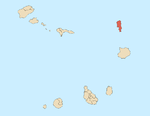
Mountains and hills Points and promontories Lighthouses Other geographical features Other topics
 Cape Verde
Ilhéu Rabo de Junco is an uninhabited islet near the west coast of Sal Island, Cape Verde. It lies about 300 metres (980 feet) from the coast. It is 253 metres (830 feet) long and 165 metres (541 feet) wide, its shoreline is about 878 metres (2,881 feet) long.[1] It is the only islet near the island of Sal. Baía da Murdeira lies to the southeast of the islet. Further east is the highest point in southern Sal named Rabo de Junco, which has an elevation of 165 metres (541 feet). The islet is part of the marine nature reserve Baía da Murdeira.[2]
References
- v
- t
- e
The island of Sal, Cape Verde
- Espargos
- Murdeira
- Palmeira
- Pedra de Lume
- Santa Maria
- Terra Boa

- Morrinho de Açúcar
- Cagarral
- Monte Curral
- Monte Grande
- Rabo de Junco
- Serra Negra
- Ponta da Fragata
- Ponta do Leme Velho
- Ponta Norte
- Ponta Preta (Northern Sal)
- Ponta Preta (Southern Sal)
- Ponta do Sinó
- Ponta de Vera Cruz
- Baía da Murdeira
- Baía da Parda
- Buracona
- Ilhéu Rabo de Junco
- Praia de Santa Maria
- Santa Maria salt ponds
| ||
|---|---|---|
| Island groups |  | |
| Islands | ||
| Islets |
| |
 | This Cape Verdean location article is a stub. You can help Wikipedia by expanding it. |
- v
- t
- e


