Hargrave, Kansas
Unincorporated community in Rush County, Kansas
Unincorporated community in Kansas, United States
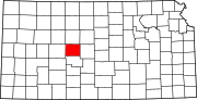
38°33′23″N 99°26′42″W / 38.55639°N 99.44500°W / 38.55639; -99.44500[1]Hargrave is an unincorporated community in Rush County, Kansas, United States.[1] It is located approximately 7 miles west of La Crosse on the north side of K-4 highway next to the Kansas and Oklahoma Railroad.
History
Hargrave had a post office between the 1890s and 1950.[2]
Education
The community is served by La Crosse USD 395 public school district.
References
- ^ a b c d U.S. Geological Survey Geographic Names Information System: Hargrave, Kansas
- ^ "Kansas Post Offices, 1828-1961". Kansas Historical Society. Archived from the original on October 9, 2013. Retrieved June 22, 2014.
Further reading
External links
- Hargrave - a Dead Town in Rush County, Kansas Agland
- Rush County maps: Current, Historic, KDOT
- v
- t
- e
Municipalities and communities of Rush County, Kansas, United States
County seat: La Crosse
communities
- Alexander-Belle Prairie
- Banner
- Big Timber
- Center
- Garfield
- Hampton-Fairview
- Illinois
- La Crosse-Brookdale
- Lone Star
- Pioneer
- Pleasantdale
- Union
- Kansas portal
- United States portal
 | This article about a location in Rush County, Kansas is a stub. You can help Wikipedia by expanding it. |
- v
- t
- e


