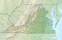
Hampton Roads Executive Airport
36°46′49″N 076°26′56″W / 36.78028°N 76.44889°W / 36.78028; -76.44889


| Direction | Length | Surface | |
|---|---|---|---|
| ft | m | ||
| 10/28 | 4,056 | 1,236 | Asphalt |
| 2/20 | 3,524 | 1,074 | Asphalt |
| Aircraft operations | 86,805 |
|---|---|
| Based aircraft | 203 |
Hampton Roads Executive Airport (ICAO: KPVG, FAA LID: PVG) is a public-use airport seven miles (11 km) southwest of Norfolk and northwest of Chesapeake, Virginia. It is privately owned by Virginia Aviation Associates, L.L.C.
Most U.S. airports use the same three-letter location identifier for the FAA and IATA, but Hampton Roads Executive Airport is PVG to the FAA and has no IATA code (IATA assigned PVG to Shanghai Pudong International Airport in China).[2][3]
Facilities
The airport covers 511 acres (207 ha) and has, after an extension completed in 2014, two asphalt runways: 10/28 is 5,350 x 100 ft (1,236 x 21 m) and 2/20 is 3,600 x 70 ft (1,074 x 21 m).[4][5]
In 2004 the airport had 86,805 aircraft operations, average 237 per day: 97% general aviation, 2% air taxi and <1% military. 203 aircraft were based at this airport: 73% single engine, 14% multi-engine, 8% helicopters and 4% ultralights.
References
- ^ http://www.gcr1.com/5010ReportRouter/PVG.pdf, effective 2007-07-05
- ^ Great Circle Mapper: KPVG - Norfolk, Virginia (Hampton Roads Executive Airport)
- ^ Great Circle Mapper: PVG / ZSPD - Shanghai, China (Pudong International Airport)
- ^ "FAA/DOAV Sponsored New Extended Runway". Hampton Roads Executive Airport. Retrieved 23 November 2016.
- ^ "Hampton Roads Executive Airport Celebrates the Grand Opening of its New 5350' Runway!". Retrieved 23 November 2016.
External links
- Hampton Roads Executive Airport
- Resources for this airport:
- FAA airport information for PVG
- AirNav airport information for PVG
- FlightAware airport information and live flight tracker
- SkyVector aeronautical chart for PVG
- v
- t
- e


