ESikhawini
Place in KwaZulu-Natal, South Africa
28°53′S 31°54′E / 28.883°S 31.900°E / -28.883; 31.900 (2001)[1]
3887
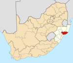
eSikhaleni popularly known as eSikhawini is a town in the King Cetshwayo District Municipality of the KwaZulu-Natal province of South Africa.
eSikhaleni is located 2 km off the N2 route. Richards Bay and Empangeni are closest towns, being both located 15–20 km away. It was established in 1976 as a black township consisting of middle income residents.[2]
Sports facilities
- Esikhawini H Ground
- Esikhawini College
- Tisand Tech High School
- Sithole place
- Tebugho (social work welfare)
- Thabiso center
- Dephini ground
Places
- Madlankala Reserve
- Madlankala village
- Mabuyeni
- Esikhawini J
- Esikhawini H
- Dube village Found on the northern outskirts of the H section it is one of the oldest villages of Esikhawini.
- Gobandlovu Reserve
- PortDunFord (PD)
References
- ^ a b c d "Main Place ESikhawini". Census 2001.
- ^ "Planning for Recreational Facilities and Open Spaces: A Case Study of ESikhawini Township at Umhlathuze Municipality, KwaZulu Natal" (PDF). University of KwaZulu-Natal. Retrieved 4 January 2014.
- v
- t
- e
Municipalities and communities of King Cetshwayo District Municipality, KwaZulu-Natal
District seat: Richards Bay
- eMpangeni
- eSikhawini
- Felixton
- Richards Bay
Authority control databases | |
|---|---|
| International |
|
| National |
|
 | This KwaZulu-Natal location article is a stub. You can help Wikipedia by expanding it. |
- v
- t
- e


