Division No. 17, Manitoba
Census division in Manitoba, Canada

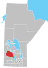
Census Division No. 17 (Dauphin) is a census division located within the Parklands Region of the province of Manitoba, Canada. Unlike in some other provinces, census divisions do not reflect the organization of local government in Manitoba. These areas exist solely for the purposes of statistical analysis and presentation; they have no government of their own.
The economic base of the area is primarily agriculture with some manufacturing and food processing. The population of the division at the 2006 census was 22,358. The division is geographically centred on the city of Dauphin and Dauphin Lake, and contains most of Riding Mountain National Park. Also included in the division is the Ebb and Flow First Nation.This region in located in central Manitoba.
Demographics
In the 2021 Census of Population conducted by Statistics Canada, Division No. 17 had a population of 21,996 living in 9,468 of its 11,521 total private dwellings, a change of -0.9% from its 2016 population of 22,205. With a land area of 13,630.54 km2 (5,262.78 sq mi), it had a population density of 1.6/km2 (4.2/sq mi) in 2021.[1]
City

Unincorporated communities
Municipalities
Reserve
Unorganized Area
References
- ^ "Population and dwelling counts: Canada and census divisions". Statistics Canada. February 9, 2022. Retrieved April 2, 2022.
External links
- Manotba Community Profiles: Dauphin
- v
- t
- e
| Former towns |
|---|
| Former villages |
|---|
| Former RMs |
|---|
- Ebb and Flow
- Keeseekoowenin (Partly)
- Alonsa
- Amaranth
- Ashville
- Bacon Ridge
- Bluff Creek
- Cayer
- East Bay
- Eddystone
- Fork River
- Freedale
- Garland
- Glencairn
- Halicz
- Harcus
- Keld
- Kinosota
- Laurier
- Lonely Lake
- Magnet
- Makinak
- Manitoba House
- Meharry
- Million
- Mink Creek
- Moore Dale
- Moose Bay
- Norgate
- North Junction
- Oak Brae
- Ochre River
- Paulson
- Portia
- Reedy Creek
- Reeve
- Reykjavik
- Rorketon
- Ste. Amélie
- Shergrove
- Sifton
- Silver Ridge
- Toutes Aides
- Trembowla
- Valley River
- Valpoy
- Venlaw
- Volga
- Weiden
- Zoria
Subdivisions of Manitoba | |||
|---|---|---|---|
| Subdivisions |
| ||
| Census divisions | |||
| Cities | |||
| Towns |
| ||
| Villages |
| ||
| |||

51°16′45″N 99°48′20″W / 51.27917°N 99.80556°W / 51.27917; -99.80556
 | This Manitoba location article is a stub. You can help Wikipedia by expanding it. |
- v
- t
- e


