Devina
Place in Styria, Slovenia
46°27′27.53″N 15°34′34.79″E / 46.4576472°N 15.5763306°E / 46.4576472; 15.5763306 Slovenia
 (2002)
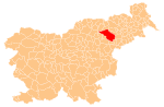
Devina (pronounced [dɛˈʋiːna]) is a settlement immediately north of Slovenska Bistrica in northeastern Slovenia. The area is part of the traditional region of Styria. It is now included with the rest of the Municipality of Slovenska Bistrica in the Drava Statistical Region.[2]
A small chapel in the village centre was built in 1947 in memory of four locals who died fighting in the Second World War.[3]
References
External links
- Devina on Geopedia
- v
- t
- e
Administrative seat: Slovenska Bistrica
- Ančnik Fort
- Bistrica Castle
- Black Lake on Pohorje
- Frajštajn Manor
- Grassel Tower
- Kebelj Parish Church
- Klemencl Mill
- Mary of the Seven Sorrows Church
- Slovenska Bistrica Parish Church
- Štatenberg Mansion
- St. Joseph's Church
- St. Martin on Pohorje Parish Church
- Zgornja Polskava Mansion
 | This article about the Municipality of Slovenska Bistrica in Slovenia is a stub. You can help Wikipedia by expanding it. |
- v
- t
- e


